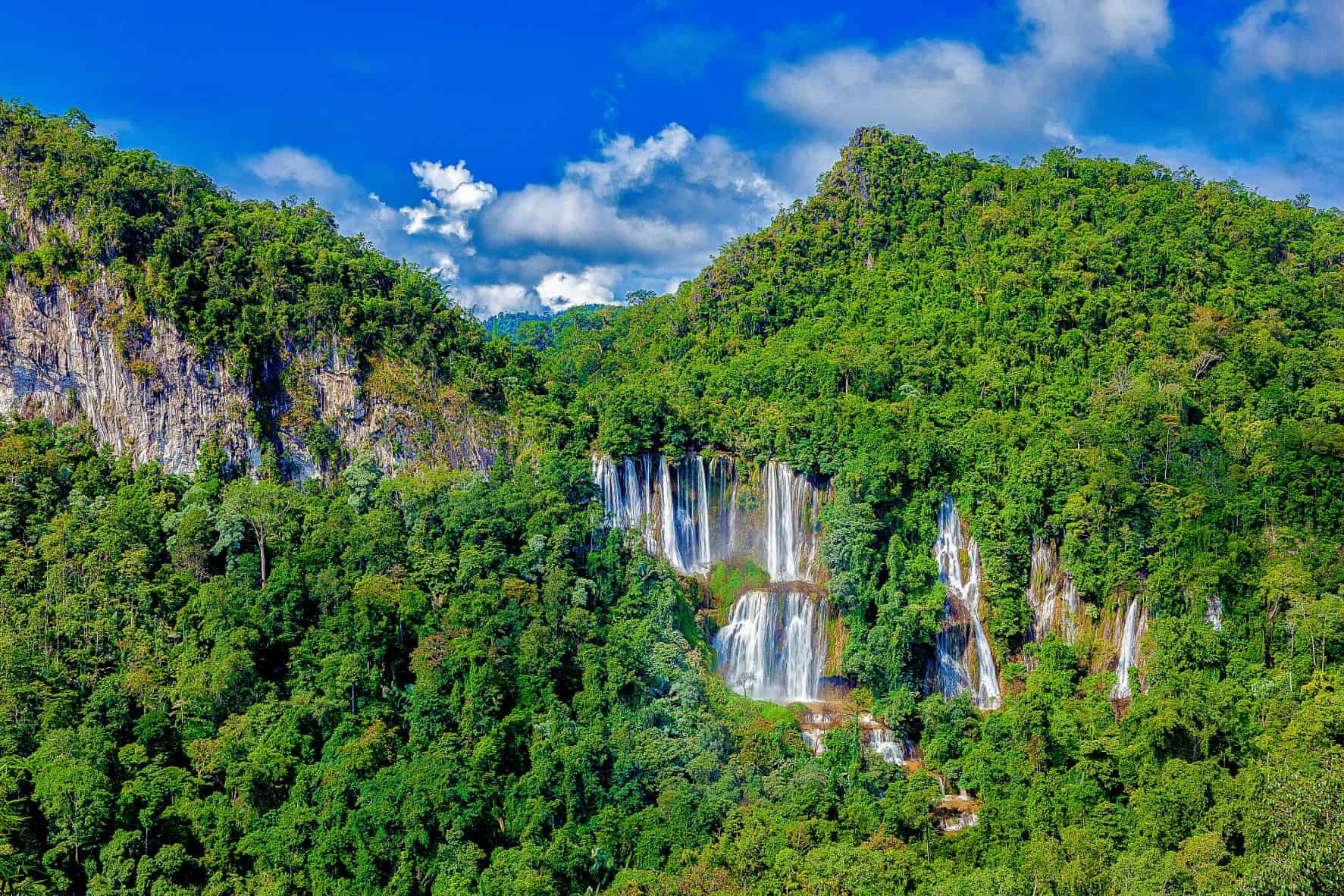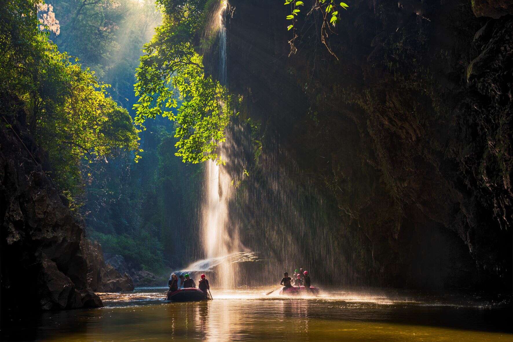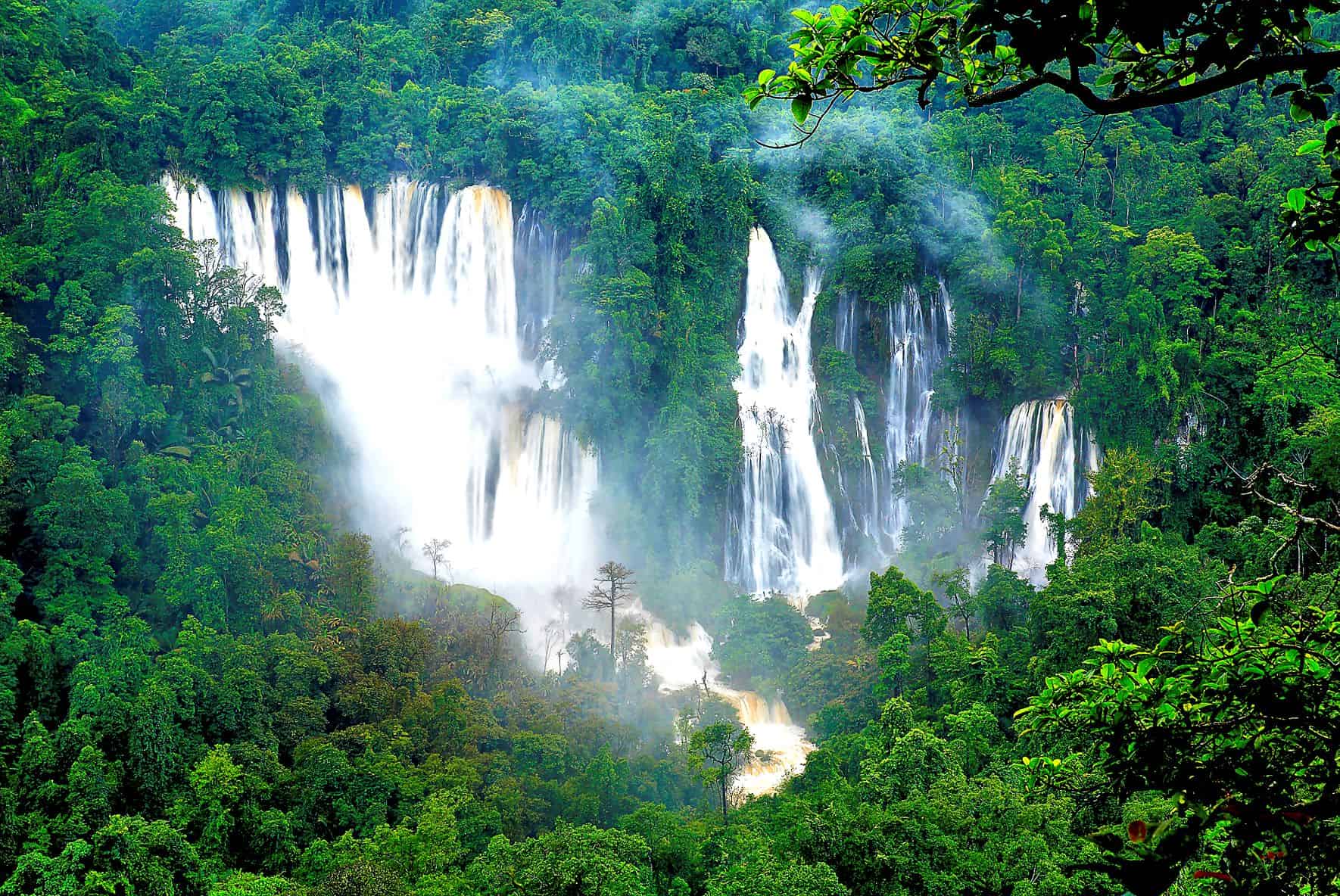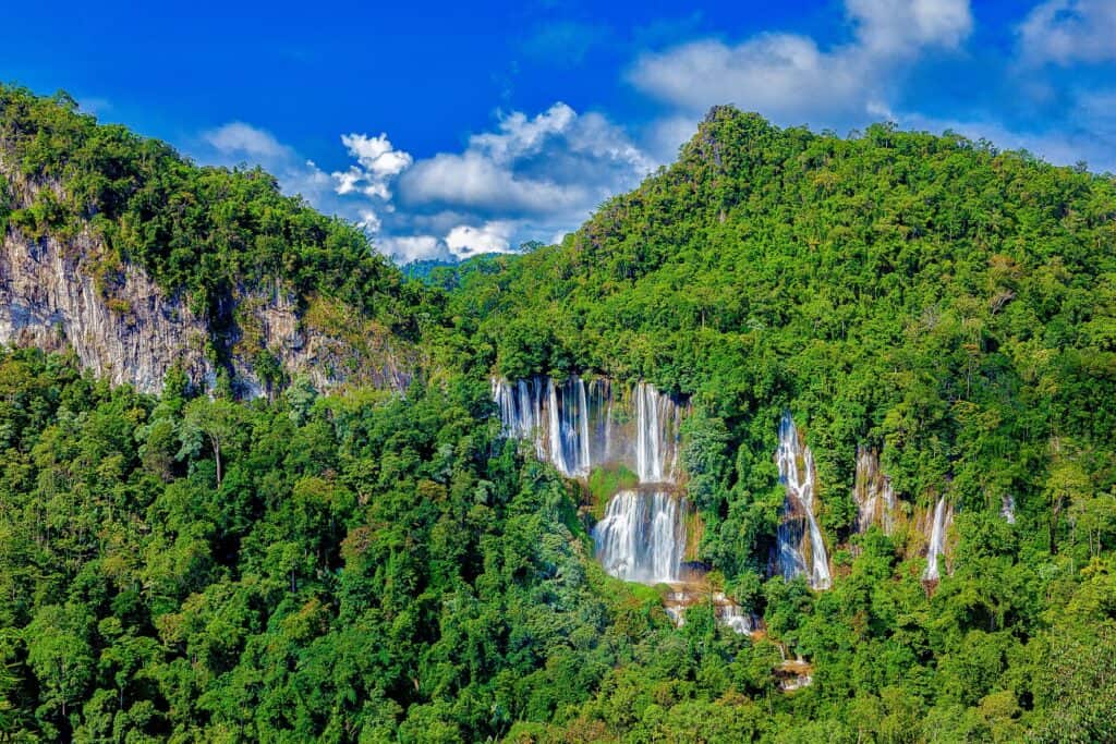
Key Attractions: Thi Lo Su Waterfall The largest limestone mountain waterfall in Thailand, located 900 metres above sea level, originating from Klo Tho Creek cascading along a steep cliff. This multi-tiered waterfall flows strongly all year round. It is about 500 metres wide and 300 metres high, surrounded by lush evergreen forest. The name “Thi Lo Su” comes from the Karen language, meaning “black waterfall.” To get there: By car-From Umphang District, follow Highway No. 1090 (Umphang-Mae Sot route) and take a right turn at Km. 161 (Ban Mae Klong Mai) onto Highway No. 1288 (Ban Mae Klong Mai -Beung Keung) to Delo Pass or the “Umphang Wildlife Sanctuary” checkpoint for 50 kilometres. Visitors should use a pick-up truck or a four-wheel drive car which has high performance. During the rainy season, the route is closed to vehicles to allow forest recovery, and access to tourism during this period requires prior permission from sanctuary officials. There are two access routes; Rafting from Tha Sai, Umphang District along Mae Klong River, a 3-hour journey, followed by a 3-hour, 10-kilometre trek to Thi Lo Su. A 25-kilometre, 4-5-hour trek from Huai Nong Luang ranger station to Thi Lo Su. Thi Lo Cho Waterfall (Namtok Saifon) Located 3 kilometres from Umphang District, accessible by a 40-minute bamboo raft trip along the Mae Klong River, reaching an 80-metres-high waterfall. Thi Lo Re Waterfall Situated on a cliff overhang, resembling a cave on the edge of Mae Klong River, with a large stream flowing over a steep cliff into Mae Klong River, 80 metres high, ideal for adventure tourism and nature studies. To get there: Take the Umphang-Ban Pa La Tha route, starting from the Karen village of Pa La Tha on a rubber dinghy along the Mae Klong River for around 3 days. Note: Visitors must prepare their own meals and camping equipment. Ko Tha Waterfall A beautiful, large waterfall over 100 metres wide and 120 metres high, cascadi