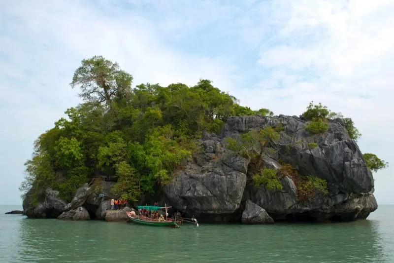
Khao Hin Phap Pha is a sea cliff on Ko Nui, a small island inside Hat Khanom–Mu Ko Thale Tai National Park, and it’s reachable only by boat — roughly 30 minutes out from Laem Prathap pier in Khanom. There’s no trail, no cave system, and no walking access; this is a stop on a Khanom island-hopping boat trip, not a hike.
The cliff runs about 500 metres along the shoreline, 100 metres deep and 20 metres high, built from tightly stacked layers of sedimentary rock laid down on an ancient seabed and later exposed by erosion and shifting land. The layering is tight and regular enough that it reads, from a boat a short distance off, like folded fabric — which is exactly what the Thai name says: “hin phap pha” translates to “folded-cloth rock.” English-speaking visitors call it “Pancake Rock,” a nod to the similar-looking Pancake Rocks at Punakaiki in New Zealand, though this formation is smaller and can only be seen from the water.
Boat operators in Khanom usually pair Khao Hin Phap Pha with a run past neighbouring islets — Koh Tao Rai and Koh Nui Nok among them — rather than sending a boat out for this single stop. Expect a slow pass along the cliff face for photos rather than a landing; the rock and the surrounding water are the whole point, and there’s nowhere to disembark. Sea conditions dictate whether a trip runs at all: Khanom sits on the Gulf coast, so the October–December monsoon window brings choppier water and more cancellations than the December–April dry season.
Insider Tip: Ask for morning departures — the light rakes across the layered rock face at a low angle early in the day, which brings out the “folded” texture far better than the flatter light of a midday pass.
Watch out: There’s no fixed schedule or ticket booth for this specific stop — it only happens as part of a chartered or shared Khanom boat tour, so confirm with the operator that Khao Hin Phap Pha (not just the more heavily marketed Koh Nui swimming stop) is actually on the day’s route before booking.
- Access: Boat only, ~30 min from Laem Prathap pier, Khanom
- Size: ~500 m long, 100 m deep, 20 m high
- Location: Ko Nui, Hat Khanom–Mu Ko Thale Tai National Park
- Nickname: “Pancake Rock” — layered sedimentary cliff
- Best season: December–April (Gulf coast dry season)
Location & Directions
Mu 6
Khanom, Thailand
Show your taxi or Grab driver
เขาหินพับผ้า
Within Walking Distance

Frequently Asked Questions
Can I hike to Khao Hin Phap Pha?
What does "Hin Phap Pha" mean?
Is it really like the Pancake Rocks in New Zealand?
What's the best time to visit?
Is there an entrance fee?
Spotted something out of date or incorrect? Let us know
Stay Near Khao Hin Phap Pha
Compare places to stay in Khanom, or open the map for options closest to the attraction.