Nam Dung Beach isn’t on a lake at all — it’s a sandbar and rock outcrop on the Yom River in Pong district, part of Phayao province, exposed each dry season when the water drops low enough to reveal a stretch of sand and stone in the middle of the current. The name comes from the sound the river makes rushing over the rocks here, not from any connection to Kwan Phayao, the province’s famous lake, which sits roughly 60 km away near Phayao town.
The river carves through a series of rocky outcrops here, and when water levels fall from March into early May, sand builds up between the stones to form a genuine, walkable beach — pale sand meeting clear, moving river water rather than the still lake surface some listings describe. Locals from Pong district treat it as a seasonal swimming spot: shallow pools form between rock formations that are calmer than the main channel, and it’s common to see families wading and kids playing on the exposed sandbar during the hottest months. Songkran in mid-April is the busiest stretch, when Pong district residents and visitors from nearby Chiang Muan and Chun districts head out for water play before the rains arrive and submerge the sandbar again.
Watch out: This is a river, not a swimming pool. Water levels and current strength change with rainfall upstream, and there’s no lifeguard or marked safe-swimming zone. Stick to the shallow rock pools near the exposed sandbar rather than wading into the main channel, and don’t visit expecting sand or safe wading once the rains start in June.
Facilities are basic — a scattering of food vendors sets up during the peak March-to-May season selling grilled river fish and northern Thai snacks, but outside that window there may be nobody there at all. Shade comes from whatever trees line the riverbank rather than built structures. The appeal here is the setting: rock and sand mid-river with forested hills around Pong district in the background, a very different picture from the Andaman or Gulf coast beaches most visitors picture when they hear “Thai beach.”
Insider Tip: Weekday mornings outside the Songkran rush are the quietest time — the sandbar empties out once school holidays end, even though the water level stays low enough to visit through most of April.
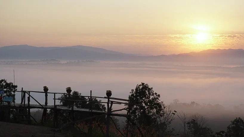
Getting there means driving or riding a motorbike along the Pong-Chiang Muan road, about 15 km from Pong district town, then following signs roughly 1 km off the main road to the riverside parking area. There’s no reliable public songthaew service directly to the site, so a private vehicle is the realistic option. Bring your own water, sunscreen, and a change of clothes — shops nearby are limited to seasonal snack stalls, not general stores. If you’re already exploring Pong district, Phu Lang Ka National Park is the other big draw in the same area, known for its sea-of-mist viewpoint at dawn.
- Water body: Yom River sandbar/rock outcrop (not Kwan Phayao lake)
- Best time: March-early May, dry season low water; busiest at Songkran
- Entry fee: Free
- Access: ~15 km from Pong district town via the Pong-Chiang Muan road, then ~1 km on a signed side track
- Facilities: Minimal — seasonal food stalls only, no lifeguard
Location & Directions
Pong, Phayao
Phayao, Thailand
Show your taxi or Grab driver
หาดน้ำดัง
Frequently Asked Questions
Is Nam Dung Beach on Phayao Lake (Kwan Phayao)?
Why is it called Nam Dung (loud water)?
When is the best time to visit?
Is there an entry fee?
How do you get to Nam Dung Beach?
Spotted something out of date or incorrect? Let us know
Stay Near Nam Dung Beach
Compare places to stay in Phayao, or open the map for options closest to the attraction.