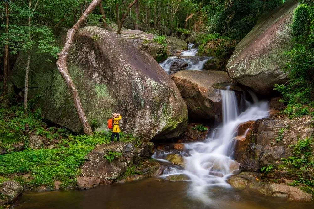
Namtok Sai Khu drops through nine distinct tiers on the western side of the Tanao Si mountain range, inside the Khao Luang Chumphon Wildlife Sanctuary in Prachuap Khiri Khan’s Bang Saphan district. The name comes from the fourth tier, where two large sai (banyan) trees stand over the cliff edge — sai khu means “twin banyans.” Entry is free, and the falls are reported to run year-round rather than drying up outside the rains, unlike many smaller falls on the peninsula.
The lower tiers, two and three, are modest and easy — shallow enough for wading, a reasonable stop if you’re short on time or travelling with young kids. Most visitors push on to tiers four through six, the section locals point to as the highlight: tier five carries water down roughly 50 metres of open rock face and is generally rated the most dramatic of the nine. Reaching tier six takes more scrambling than the tiers below it, and isn’t the place for flip-flops.
Watch out: The falls are a genuine forest hike, not a roadside stop — the last stretch to the car park runs about 300 metres and standard sedans can struggle with it in wet weather; a 4x4 or high-clearance vehicle handles it more comfortably. Trail conditions get slick after rain, particularly on the rock approaching tier five.
The site is open daily, roughly 08:00 to 17:00, and sits about 24 km from Bang Saphan town off Phetkasem Road. It’s a working wildlife sanctuary rather than a manicured park — expect basic facilities and a genuinely forested walk rather than paved paths throughout. Namtok Huai Yang National Park, further south in Thap Sakae district, is the nearest comparable waterfall if you want to see two in one trip.
- Entry fee: Free
- Hours: Daily, roughly 08:00–17:00
- Tiers: 9, with tier 5 rated the most scenic
- Managed by: Khao Luang Chumphon Wildlife Sanctuary (not a national park)
- Distance: About 24 km from Bang Saphan town
Location & Directions
Mu 3 Tambon Ron Thong
Prachuap Khiri Khan, Thailand
Show your taxi or Grab driver
น้ำตกไทรคู่
Frequently Asked Questions
How many tiers does Namtok Sai Khu have?
Does the waterfall run dry outside the rainy season?
Is it inside a national park?
Is entry free?
How far is it from Bang Saphan town?
Spotted something out of date or incorrect? Let us know
Stay Near Namtok Sai Khu
Live prices for places closest to Namtok Sai Khu — tap a pin to compare.