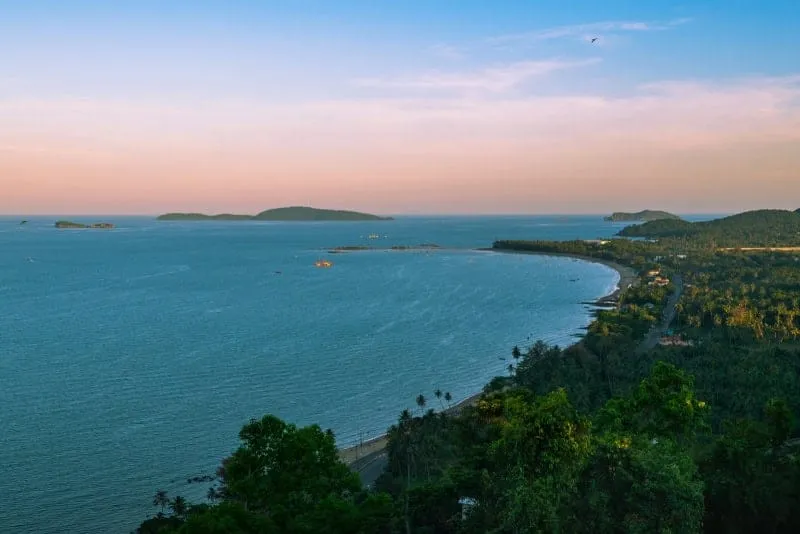
Khao Chao Mueang is Mueang Chumphon district’s highest viewpoint, a short climb inland from Hat Sai Ri beach that looks straight out over the coast to the islands of the Chumphon Archipelago. It’s a modest hill, not a serious trek, reachable without hiking gear or mountaineering experience, which makes it a regular stop for local families as much as visiting travellers.
Forest trail covers most of the ascent, cicadas and birdsong filling the canopy overhead as the path climbs past vine-draped trunks and root-stepped ground. Breaks in the tree cover open onto framed views of the coastline below before the summit clears fully, giving a preview of what’s waiting at the top: open water, scattered islands, and on a clear day the outline of Ko Thalu and Ko Ngam Yai riding the horizon. It’s a different register of Chumphon than the beach towns further south: quieter, greener, and built around one payoff view rather than a strip of resorts.
Insider Tip: Climb before 10am. Cloud and coastal haze build through the day, and the archipelago view that makes the hike worth it can disappear behind a heat shimmer by early afternoon.
Watch out: There’s no public transport to the trailhead in Mu 7 village. You need a car, motorbike, or taxi arranged from Chumphon town, about 20km away via Hwy 4119/4098.
The obvious pairing is Hat Sai Ri, 2.4km away, with its pine-lined beach and the Prince of Chumphon memorial. Climb Khao Chao Mueang in the cool of the morning, then head down to the sand once the day heats up. Both sit within reach of Chumphon town for onward transport.
- Cost: Free
- Hours: Daily 08:00-17:00
- View: Chumphon coastline and the Chumphon Archipelago islands offshore
- Distance from Hat Sai Ri beach: About 2.4km
- Access: Own transport to Mu 7 village, Hat Sai Ri subdistrict, no public transport to the trailhead
Location & Directions
Mu 7, Hat Sai Ri, Mueang Chumphon
Chumphon, Thailand
Show your taxi or Grab driver
เขาเจ้าเมือง
Frequently Asked Questions
What can you see from the top of Khao Chao Mueang?
Is it a difficult climb?
How do I get there from Chumphon town?
Can I combine this with Hat Sai Ri beach?
Spotted something out of date or incorrect? Let us know
Stay Near Khao Chao Mueang
Live prices for places closest to Khao Chao Mueang: tap a pin to compare.