




Srinagarindra Dam
เขื่อนศรีนครินทร์
Srinagarindra Dam is Thailand’s largest earth-fill dam, built across the Khwae Yai River in Si Sawat district and operated by EGAT (the Electricity Generating Authority of Thailand). The dam crest, viewpoint, gardens, and learning centre are free to visit daily, a different arrangement from the ticketed Khuean Srinagarindra National Park that covers another stretch of the same reservoir further inland.
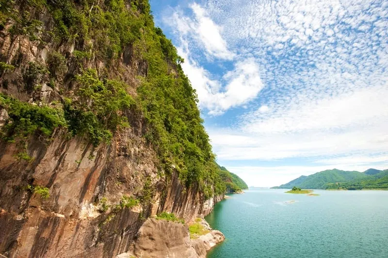
Most visitors park near the dam crest and walk out onto it for the view: a wide sheet of water backed by limestone hills, with the powerhouse and spillway visible below. EGAT’s Rachanurak Learning Center, open Monday-Saturday 08:00-16:00, runs interactive exhibits on the watershed and local ecology, a reasonable stop if the heat drives you indoors between trails. Two marked walking routes start near the visitor area: a 1,900-metre trail with six interpretive stations leading to viewpoints over the dam and the Phaya Erawan cliff, and a shorter 330-metre elevated wooden walkway through forest canopy, better suited to anyone short on time or mobility. A 30-acre Time Remembrance Garden, built to mark Princess Sirindhorn’s 90th birthday, sits along the reservoir bank with a sundial as its centrepiece.
The reservoir itself is where the bigger trips happen, mostly organised out of Si Sawat district or Kanchanaburi town rather than at the dam grounds: longtail boats run out to floating raft houses, limestone caves, and secluded coves further from the dam wall, and multi-day raft stays are a genuine local tourism niche here. EGAT also runs a guest house and two restaurants (Ruen Tara and Aravarn, both open 07:00-22:00 with kitchens closing at 21:00) plus a stall selling local products like dried fish, fried tilapia, and preserved tamarind.
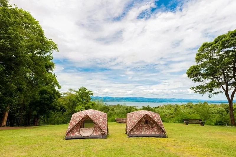
Watch out: Don’t confuse this with Khuean Srinagarindra National Park when booking a driver or tour: that’s a separate, ticketed site (around 300 THB for foreign adults) further along the reservoir with the Huai Mae Khamin waterfall as its main draw. A driver told simply “Srinagarindra” without more detail may take you to either one.
Insider Tip: The elevated 330-metre canopy walkway is the better pick if you’re visiting midday: it’s shaded most of the way, unlike the longer trail to the dam and cliff viewpoints.
- Entry fee: Free (dam crest, gardens, learning centre, trails)
- Learning centre hours: Mon-Sat 08:00-16:00
- Trails: 1,900m (6 viewpoints) or 330m elevated canopy walk
- Operator: EGAT (Electricity Generating Authority of Thailand)
- From Kanchanaburi town: ~65-75 km, 1.5-2 hours by road
For the ticketed national park headquarters and camping, see Khuean Srinagarindra National Park, and for the waterfall itself, Huay Mae Khamin Waterfall. A round at the nearby Srinagarindra Dam Golf Course pairs naturally with a stop at the viewpoint. Base yourself in Kanchanaburi for the wider trip.
Location & Directions
Si Sawat, Kanchanaburi
Kanchanaburi, Thailand
Show your taxi or Grab driver
เขื่อนศรีนครินทร์
Frequently Asked Questions
Is Srinagarindra Dam free to visit?
What can you actually do at the dam itself?
Is this the same place as the national park with the waterfall?
Can you take a boat trip on the reservoir?
How far is the dam from Kanchanaburi town?
Spotted something out of date or incorrect? Let us know
Popular tours in Kanchanaburi




Stay Near Srinagarindra Dam
Live prices for places closest to Srinagarindra Dam: tap a pin to compare.