The Mae Hong Son Loop is a 600-kilometre mountain circuit through the northwest of Thailand, typically completed in four to five days by motorbike or car. The route passes through national parks, Karen and hill-tribe villages, limestone caves, and misty viewpoints that are far from the typical Thailand tourist trail. This guide covers how to travel the loop, where to stay, and the highlights worth slowing down for.
Quick answer
The Mae Hong Son Loop is best as a four- to five-day route from Chiang Mai, with overnight stops in Pai, Mae Hong Son, and small mountain towns along the way. Experienced riders often choose a motorbike; first-timers, families, and rainy-season travellers are usually better in a car with more margin.
| Best for | Route style | Why it works | Main tradeoff |
|---|---|---|---|
| Classic first loop | 4 to 5 days from Chiang Mai | Enough time for Pai, Mae Hong Son, caves, and viewpoints | Still includes long mountain driving |
| Slow travel | 6 to 7 days | More time for side trips and rest days | Needs extra accommodation planning |
| Experienced riders | Motorbike loop | Flexible stops and mountain-road feel | Fatigue and rain increase risk |
| Comfort and luggage | Car or private driver | Better for couples, families, and wet weather | Less open-air freedom |
How we picked this Mae Hong Son Loop itinerary
We focused on route pacing, overnight logistics, road fatigue, and the stops most travellers actually build around. We did not add aggressive daily mileage because the mountain roads are the point of the trip, not something to rush through.
How to choose
Choose the route pace based on the least confident driver or rider in your group. If anyone is unsure on mountain roads, slow the itinerary down or use a car.
Mae Hong Son Loop Overview
The Mae Hong Son Loop is a mountain route through northwestern Thailand. It is roughly 600 kilometres long and is usually completed in four to five days, although slower trips are easier on the driver and give you more time for caves, viewpoints, small towns, and rest stops.
A clockwise loop from Chiang Mai follows Highway 108 south through Mae Sariang and north to Mae Hong Son. Highway 1095 then runs through Pang Mapha and Pai before reconnecting with the Chiang Mai road network. Doi Pha Hom Pok is a separate northern detour rather than a normal loop stop. Tham Pla-Namtok Pha Suea National Park is known for Fish Cave and Pha Suea Waterfall, not a general stalactite-cave route.
The route also passes temples, Shan and northern Thai towns, hot springs, caves, and mountain villages. Add stops carefully rather than trying to force every attraction into one loop, especially if you are riding a motorbike.
Adventure riders come for the switchbacks; slower travellers come for the temples, caves, hot springs, and mountain towns. Either way, the loop is better when you leave time for weather, road fatigue, and unplanned stops.
Accommodation Options
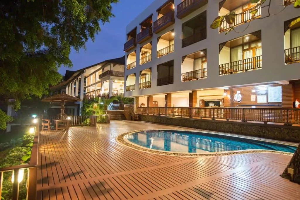
Choose accommodation by the town where you want to finish each driving day. Pai and Mae Hong Son have the widest choice, while Mae Sariang and Pang Mapha are useful for breaking up longer sections. Confirm parking, late check-in, breakfast times, and current access directly with the property.
Avoid booking a room that requires a long unlit side road after a full day of bends. Arriving before dark matters more here than a pool or a mountain-view balcony.
Highlights Along the Route
Wat Phra That Doi Kong Mu
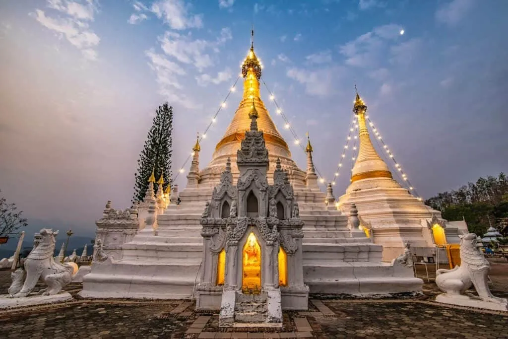
Wat Phra That Doi Kong Mu sits on a hilltop above Mae Hong Son town, with wide valley views and a calm temple setting. It is an easy stop before or after staying in town.
Tham Lod Cave
Another highlight along the route is Tham Lod Cave, near Soppong. Visits require a local guide, and some routes include a bamboo raft section through the cave. Route length and access depend on water levels and the section open that day.
Namtok Mae Surin National Park
Namtok Mae Surin National Park, near Khun Yuam district, adds waterfalls, forest, viewpoints, and hiking options to the loop. Check conditions before detouring, especially after rain.
Viewpoints Along The Route
Viewpoints appear throughout the route, but visibility changes with rain, cloud, and seasonal smoke. Ban Rak Thai lies north of Mae Hong Son town toward Pang Ung, while Pang Mapha, Huai Nam Dang, and Pai Canyon fit the Highway 1095 side of the loop. Doi Inthanon is a separate detour south of Chiang Mai.
From the striking mountain views to the traditional hill tribe villages, this Mae Hong Son Loop itinerary has options for most travellers – now let’s look at where you can stay during your journey!
Tips for Traveling the Loop
What to Pack
When traveling the Mae Hong Son Loop, pack appropriately. Bring comfortable shoes for walking and exploring, plus light layers for when temperatures drop in the evening. Don’t forget sunscreen and insect repellent — it’s also worth throwing in some snacks or energy bars for long stretches of road between stops.
When To Go
The cooler, drier months are usually easier for road grip and visibility, though smoke can affect northern Thailand late in the dry season. Hot-season heat and rainy-season downpours make long riding days harder. Check weather, air quality, and road reports before leaving Chiang Mai.
Transportation Options
Carry a licence valid for the vehicle class and any International Driving Permit required for your licence. Motorcycle riders need motorcycle entitlement, not only a car licence. Confirm that the rental agreement and travel insurance cover the vehicle, wear a helmet, and inspect the tyres and brakes before departure.
Do not use this loop to learn to ride. Avoid darkness and heavy rain, take regular breaks, and switch to a car or driver if the mountain roads exceed your experience.
Accommodation Options
Accommodation options vary depending on budget and personal preference, ranging from hostels, guesthouses, resorts to luxury hotels located near popular attractions throughout Mae Hong Son Loop. For those looking for something unique there are plenty of homestays available which offer visitors an immersive experience into local culture while providing comfortable lodging at reasonable rates.
Take your time and avoid riding or driving after dark if you can.
The Mae Hong Son Loop rewards slower planning. Choose the number of nights first, then build the route around daylight, road confidence, weather, and the stops you most want to see.