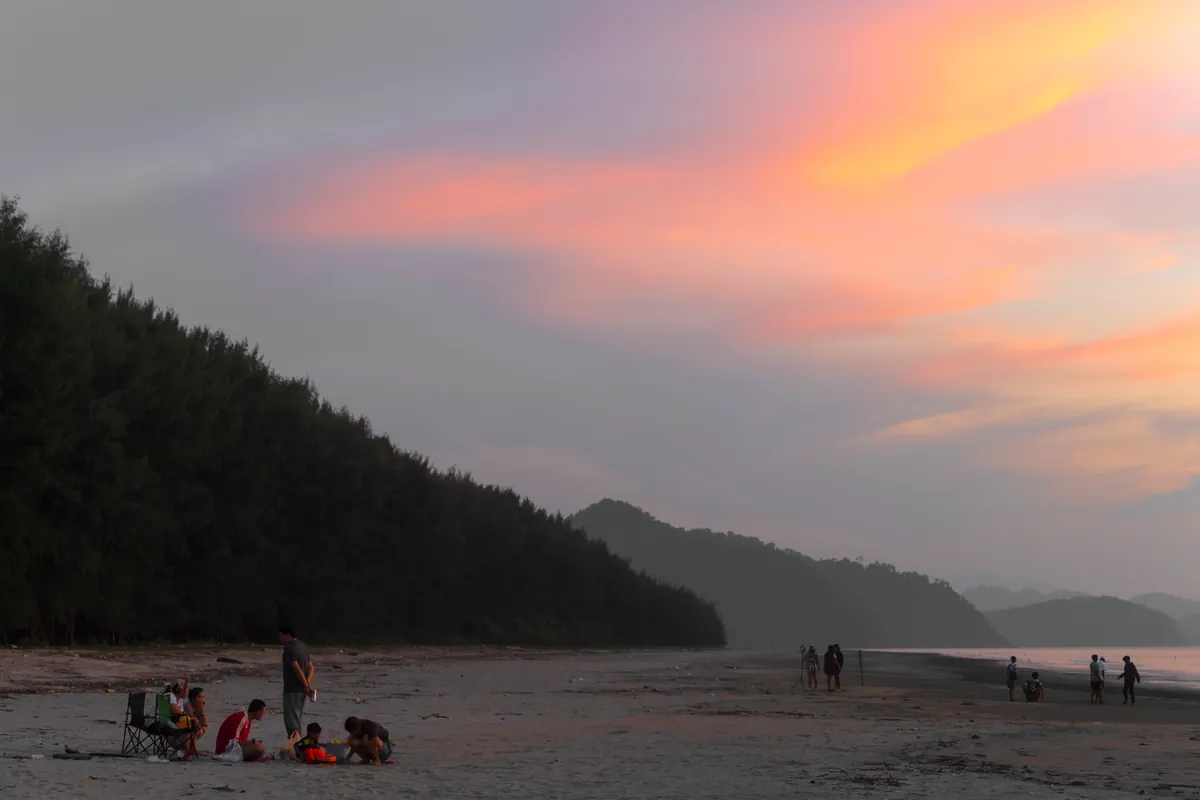
Hat Chan Damri is a hilltop sunset viewpoint and beach about 9 kilometres from Ranong town via Highway 4004, the coastal road toward Pak Nam. The main draw sits on a hill roughly 200 metres before the beach itself, where a lookout takes in the Pak Nam Ranong community, a scatter of Andaman islands, and (across the water) Victoria Point (Kawthaung) on the Myanmar side. Entry is free.
A wooden bridge extends out from the shoreline, a popular spot for photos and for watching boats working the strait between Thailand and Myanmar. A pier nearby serves boats running trips out to nearby islands, and there’s a resort in the immediate area for anyone wanting to stay overnight rather than visit as a day trip from Ranong town. Local write-ups consistently frame this as a viewpoint-and-sunset destination rather than a swimming beach. None of the sources describing it mention water conditions or safe swimming, so it’s best approached with sunset photography as the goal rather than a day on the sand.
Insider Tip: Time your visit for late afternoon and give yourself time on the hill before the beach itself: the elevated lookout is the actual draw here, and the light over the strait toward Myanmar is best in the last hour before sunset.
The beach sits on the mainland coast of Mueang Ranong district, not on Koh Phayam or any of Ranong’s offshore islands, so it’s a straightforward motorbike or car trip from town rather than a boat crossing. Facilities are limited to what’s near the pier and resort; don’t expect a developed beachfront with rows of vendors.
Watch out: Because this is a lightly developed local spot, don’t expect lifeguards, marked swimming areas, or much shade beyond what a few trees provide. Bring water and sun protection for the walk up to the viewpoint.
- Entry fee: Free
- Distance from Ranong town: About 9 km via Highway 4004
- Main feature: Hilltop sunset viewpoint plus wooden pier
- View across the water: Victoria Point (Kawthaung), Myanmar
- Best time: Late afternoon into sunset
Ranong town itself holds a cluster of easy add-ons for the same trip, including the Raksawarin Hot Springs and Public Park and the Governor’s Residence, both a short drive from Hat Chan Damri.
Location & Directions
Mueang Ranong, Ranong
Ranong, Thailand
Show your taxi or Grab driver
หาดชาญดำริ
Frequently Asked Questions
Is Hat Chan Damri good for swimming?
Is there an entrance fee?
How far is it from Ranong town?
Can you really see Myanmar from here?
What is there to do besides the view?
Spotted something out of date or incorrect? Let us know
Stay Near Hat Chan Damri
Live prices for places closest to Hat Chan Damri: tap a pin to compare.