


Yala
ยะลา
Thailand's most carefully planned provincial capital, a deep-south rainforest, and the border town of Betong — a province that demands honesty about its security situation.
Recommended by us

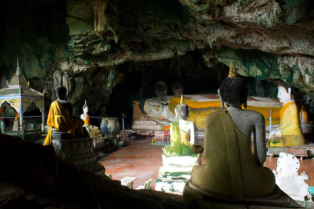
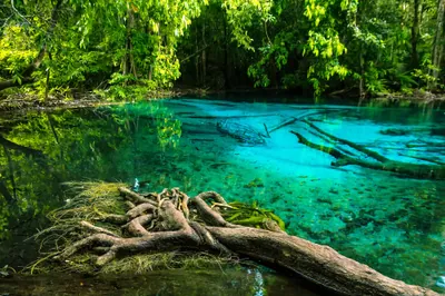
Wat Na Tham
A working Buddhist temple built inside a cave mouth — monks live here, and the Buddha images tucked into the rock feel genuinely ancient. Quieter than the famous cave temples further north.

Bang Lang National Park
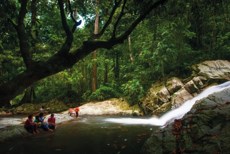
Rainforest running down to a wide reservoir on the Malaysian border. The birdwatching is serious — hornbills year-round — and the park sees very few foreign visitors.

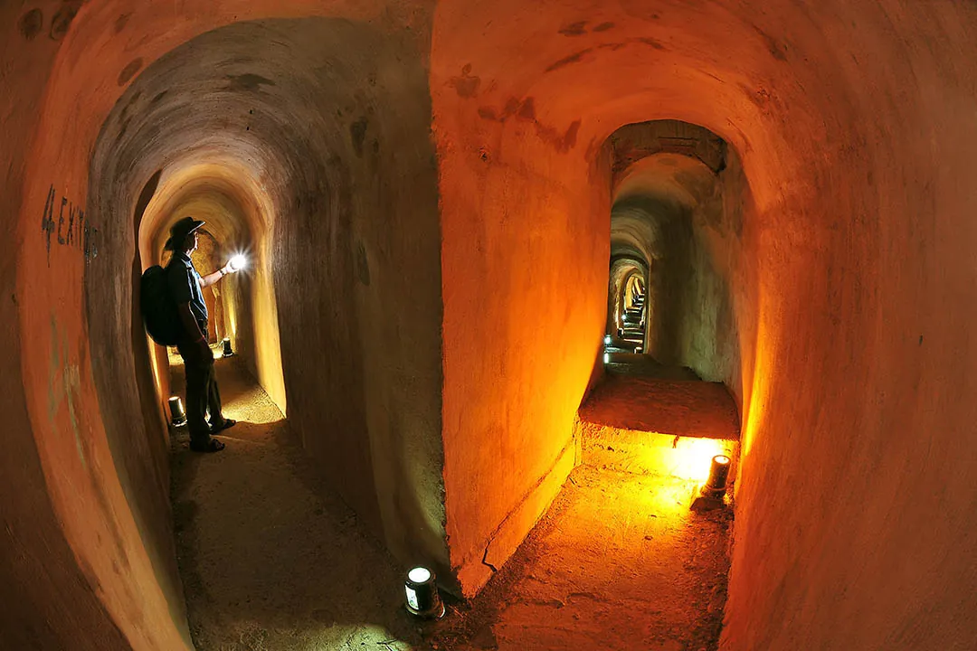
Piyamit Tunnel
An underground Communist Party supply network from the 1970s, now open to walk through. The sheer scale of what was built by hand is hard to process — bring a torch and low expectations for crowds.

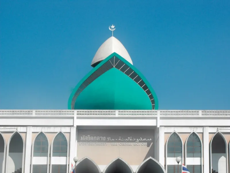
Yala Central Mosque
One of the largest mosques in Thailand, and the heart of Yala's Muslim majority city. Dress conservatively and visit outside prayer times — the architecture is worth the short detour from the town centre.

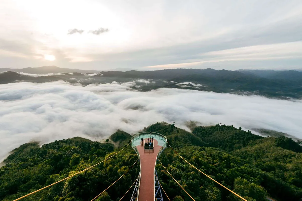
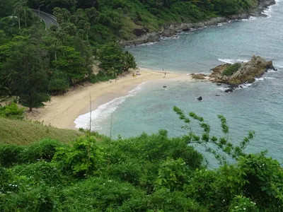
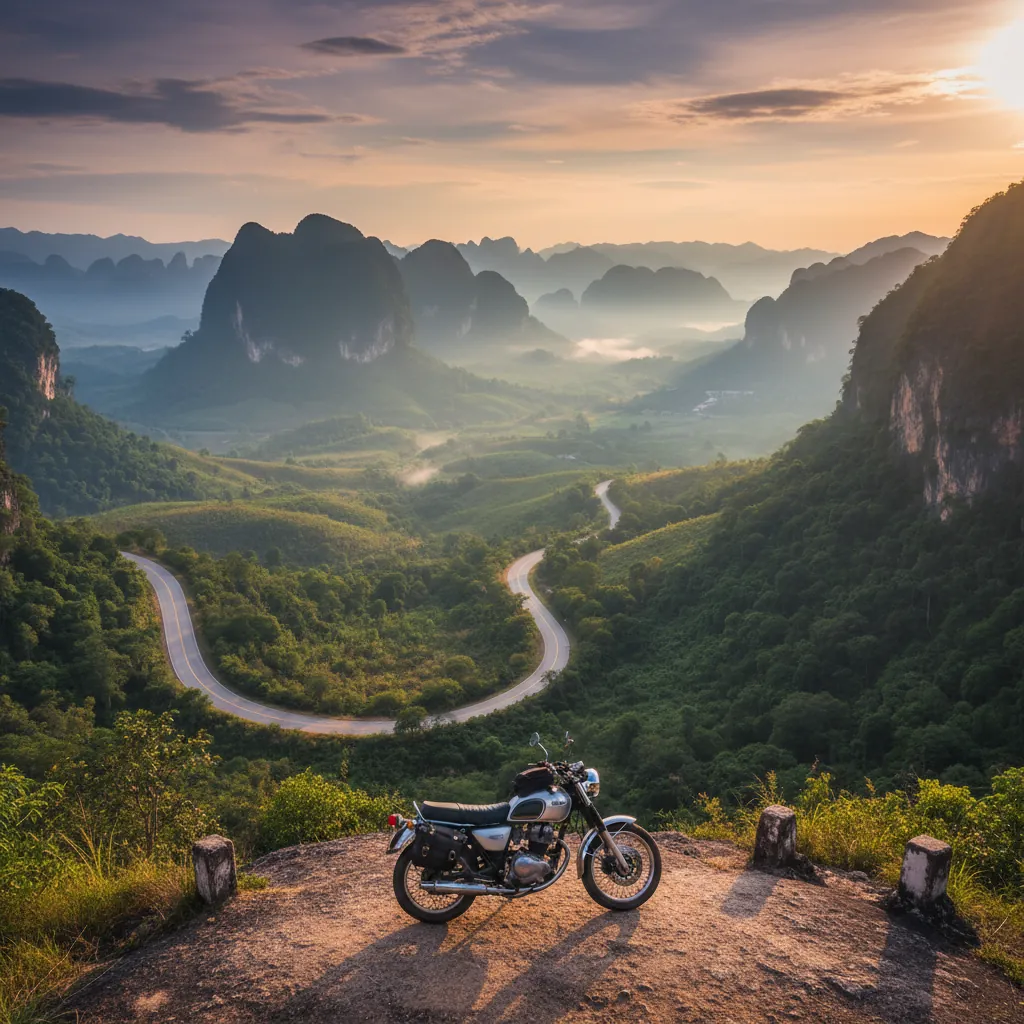
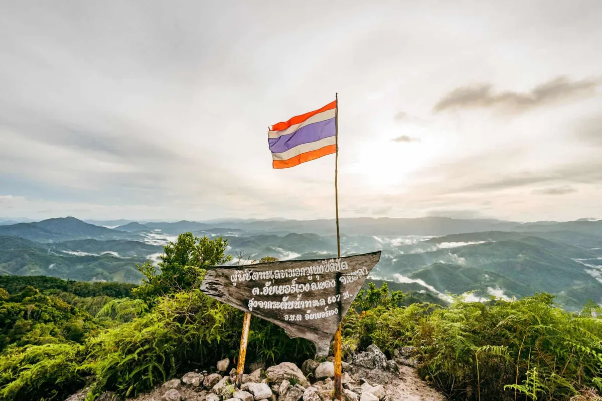
Aiyoeweng Sea of Mist
A high ridge above Betong where the valley below fills with cloud at dawn. Arrive before 06:00 in the cool season (Nov–Feb) — by 08:00 the mist has usually burned off.

Get to Yala
The overnight sleeper train from Bangkok Hua Lamphong takes roughly 18 hours and drops you in Yala city — book a berth well ahead on busy weekends.

eSIM for Thailand
Land with data already working and skip the airport SIM queue. We tested six plans — code THAIHOLIDAY saves 10%.

Travel insurance
Rainforest trails and remote border roads — sort cover before you go, and check that trekking and motorbike riding are included in your policy.
Waterfalls, peaks, caves & parks
Nature & outdoors around Yala


Museums, history & heritage
Museums & culture in Yala


Things to do on the map
Tap a pin for details — 23 places in Yala plotted.
Where to stay in Yala


When to go
Jan–Apr The dry season is the most comfortable window for Betong and Bang Lang National Park — clear mornings for the Aiyerweng sea-of-mist, lower humidity, and the best conditions for forest walks and birdwatching.
May–Aug Increasing humidity and occasional showers as the southwest monsoon builds. Betong town and the hot spring remain accessible; Bang Lang's trails can be muddy but remain open.
Sep–Dec The northeast monsoon drives the heaviest rainfall across the deep south from September through December. Roads around Bang Lang Dam can flood in October and November. The sea-of-mist phenomenon at Aiyerweng is still visible in the morning but heavy cloud reduces views on many days.
Explore around Yala
About Yala
Last updated July 2026
Overview
Yala is the southernmost province of Thailand, a landlocked territory sharing a border with Malaysia. About 72 percent of the population is Muslim and Malay-speaking, and the province sits within the historical Patani region — a distinct cultural and linguistic zone that has been part of Thailand since 1902.
Safety advisory — read this before planning a visit. The UK Foreign, Commonwealth & Development Office (FCDO) advises against all but essential travel to Yala province. The US State Department urges increased caution due to insurgent activity. The Australian DFAT rates Yala as “reconsider your need to travel.” All three advisories reflect an ongoing conflict between Thai security forces and separatist militant groups that has caused over 7,000 deaths since 2004. As of mid-2026, seventeen districts across the deep-south provinces remain under a declared state of emergency, and martial-law provisions and enhanced security measures remain in force. Checkpoints are routine on main roads. Travel insurance is typically invalidated when you travel contrary to your government’s advisory — verify your policy before booking.
This page documents the province accurately for those who need the information, including visitors with close family in the region, researchers, journalists, and Thai travellers. It is not a recommendation to visit.
For those who do travel here — whether Thai nationals, regional visitors from Malaysia, or the small number of foreign travellers who make an informed decision to go — Yala has genuine substance: a remarkable planned city, one of southern Thailand’s better national parks, and a historically significant border town built around the memory of a long-ago insurgency that itself is now museum history.
Top Things to Do
Aiyerweng Sea of Mist Viewpoint and Skywalk is the headline experience in the Betong district. The glass-floored skywalk extends 63 metres over a hillside at 621 metres above sea level, about 32 kilometres from Betong town. In the early morning — the phenomenon is most reliable between 5:30 and 7:00 am — cloud sits in the valleys below and the Titiwangsa Mountains stretch south into Malaysia. The effect is visible year-round but most consistent in the dry season. Admission is around ฿200. Arrive before dawn; views clear quickly once the sun rises.
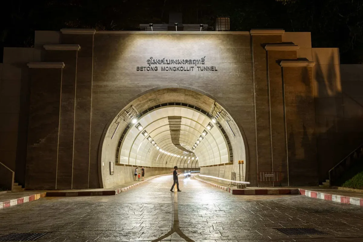
Piyamit Tunnel is one of the few places in Thailand where you can walk through a cold-war-era underground base. Built by hand in 1976 by around 50 members of the Malayan Communist Party, the 1-kilometre tunnel complex served as a jungle headquarters during the insurgency along the Thai-Malaysian border. Nine entrances connect internal rooms that housed a kitchen, medical post, sleeping quarters, and communications equipment. After a peace settlement in 1989, the group surrendered their weapons and the complex was converted to a museum. The exhibits — weapons, photographs, documents — are informative and the tunnel itself is well-maintained. It sits about 10 kilometres outside Betong.
Betong Hot Spring is 13 kilometres from Betong town in Tano Maero subdistrict. The springs reach around 80°C — hot enough to boil an egg in seven minutes in the designated cooking pool. The complex is set in green surroundings and has soaking pools at lower temperatures. It is a popular stop for Malaysian visitors crossing the border.
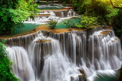
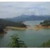
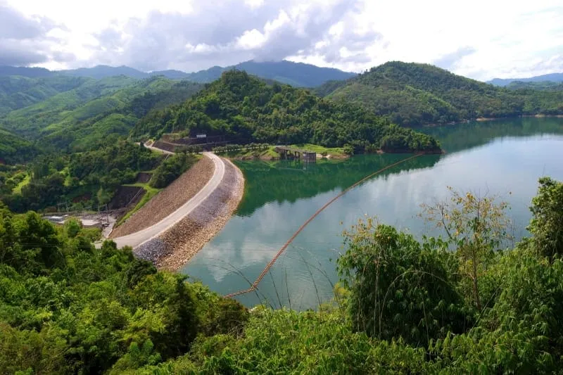
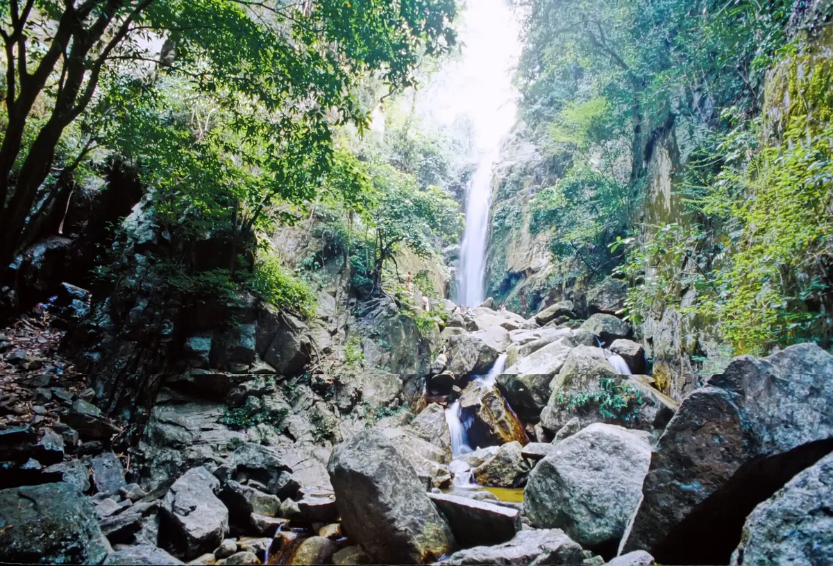
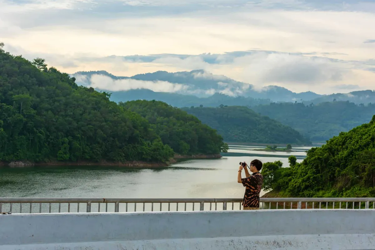
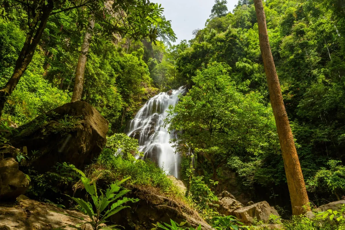
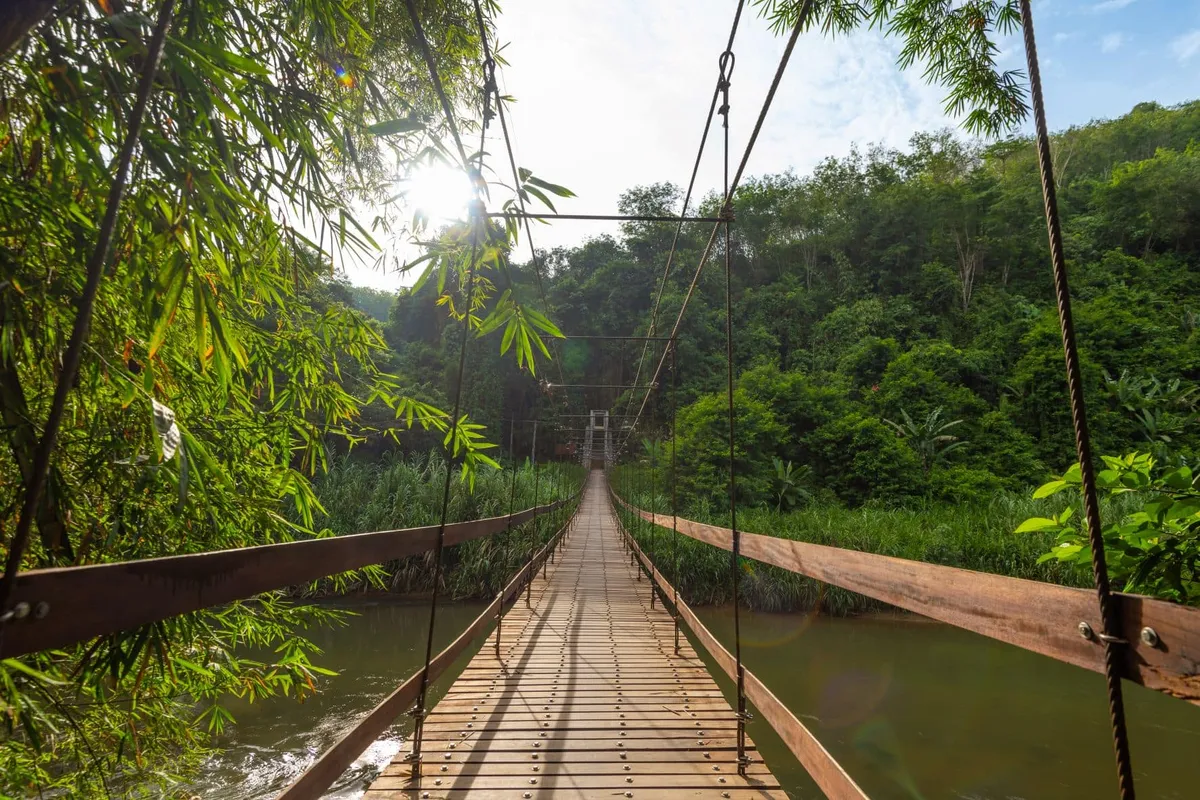
Bang Lang National Park covers 261 square kilometres of rainforest in the Banthat Mountains, declared a national park in 1999. The park holds Asian elephants, gaur, Malayan tapir, several deer species, and nine hornbill species including the Great Hornbill. Namtok Than To — a nine-tier waterfall in the items list — is one of the park’s most visited points. The Bang Lang Dam creates a reservoir where boat trips let you view the flooded forest landscape; four-hour rafting excursions are available. The park is also home to small communities of the Orang Asli (Jahai) people — an indigenous hunter-gatherer group whose population of around 400 in Yala and Narathiwat represents the northernmost extent of the Semang peoples found across the Thai-Malaysian border zone.
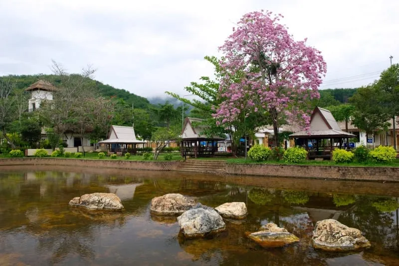
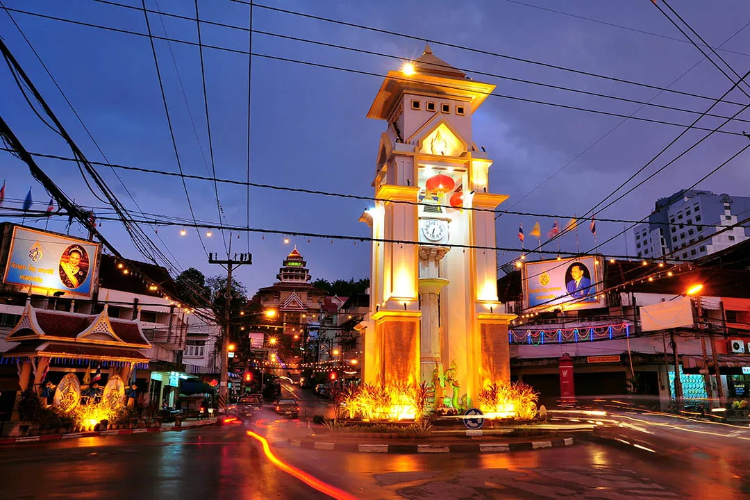
Yala city’s urban grid is worth understanding before you arrive. Most Thai provincial capitals are organic and unplanned. Yala was built differently — radial roads extend from a central point called Kilometre Zero through three concentric ring roads (Wongwian 1, 2, 3), creating a web of 400 streets across 19 square kilometres. Zoning separates government, commercial, residential, and educational areas with unusual clarity for a Thai city. Yala is known across Thailand for its unusually systematic radial grid plan — unusual for any provincial city in Southeast Asia. The result on the ground is a city of wide, tree-lined boulevards and a grid that makes orientation straightforward. Yala Central Mosque and the Yala City Pillar Shrine are the main cultural landmarks in the city centre.
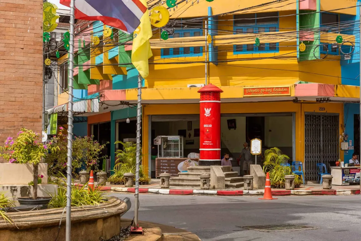
The Giant Postbox of Betong is a curiosity rather than a destination, but it is a genuine local landmark. The original mailbox on Sukyang Road was built in 1924 before World War II; a newer nine-metre-tall version near the community hall has become a favourite photo stop. The claim to “world’s largest” is contested — Guinness recognised a mailbox in Japan — but for a border town of its size, Betong takes unusual civic pride in its postal history.
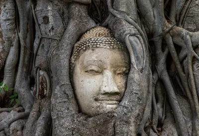
Wat Khuha Phimuk (Wat Na Tham) is a cave temple on the edge of Yala city, built into a limestone cliff. The cave contains a large reclining Buddha image and receives a steady flow of Thai Buddhist visitors. Several other working temples are distributed across the province, including Wat Phutiwhat and Wat Sai Khao, both accessible for day visits.
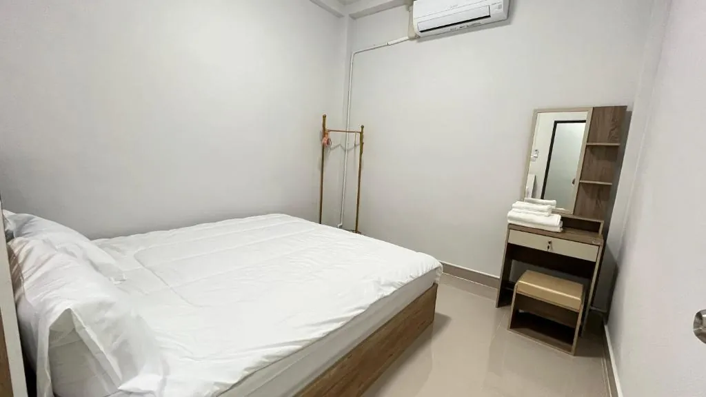
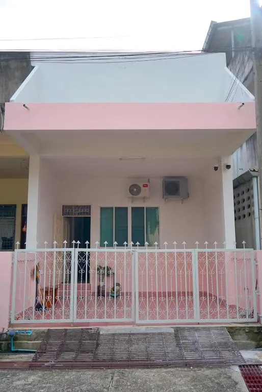
Where to Stay
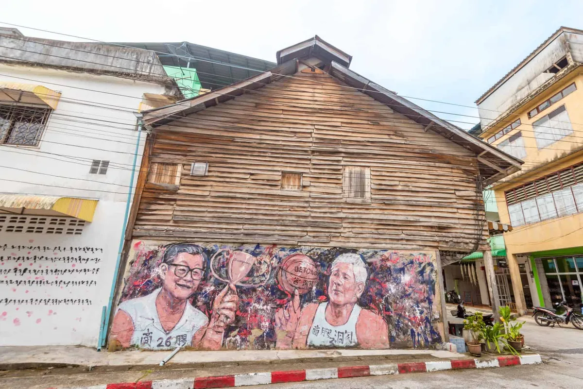
Accommodation concentrates in Betong town, which has a range of local hotels suited to both Thai domestic visitors and Malaysian cross-border travellers. The Grand Mandarin Betong is among the better mid-range options; there are also several smaller family-run hotels near the clock tower. Betong has more choice than Yala city for overnight stays if your focus is the national park and the southern sights.
Yala city has a small selection of hotels appropriate for a transit night or a visit focused on the city and Bang Lang. Neither town has international-chain properties or resort accommodation.
Getting There
The standard route from Bangkok is to fly to Hat Yai (roughly 1 hour 20 minutes, with multiple daily services from Don Mueang and Suvarnabhumi), then travel by road. Yala city is 137 kilometres southeast of Hat Yai by road — about 2.5 hours. Betong is a further three hours south of Yala city on Highway 410, a winding mountain road that descends into the border valley. Shared minivans run from Hat Yai bus terminal to Betong and take around 4.5 hours.
Train: daily services from Bangkok (Bang Sue / Krung Thep Aphiwat) reach Yala station in around 18 to 20 hours on rapid and express services. The FCDO also advises against travel on the Hat Yai to Padang Besar train line through the southern provinces.
Betong International Airport (BTZ) began limited domestic flights from Hat Yai in 2025. There is still no direct Bangkok service as of mid-2026 — check current schedules before planning to fly there.
Within the province, you need your own transport or a hired vehicle. There is no meaningful public transport between Betong and the national park or outlying sights.
Best Time to Visit
Yala follows a deep-south rainfall pattern driven primarily by the northeast monsoon, which delivers the heaviest rain from September through December — the inverse of the pattern in central Thailand. January through April is the dry season: lower humidity, reliable clear mornings for the Aiyerweng viewpoint, and the best conditions for Bang Lang National Park’s forest trails. May to August sees building humidity and occasional showers as the southwest monsoon arrives. September and October can bring significant flooding around the Bang Lang Dam area.
The province does not experience the burning-season haze (February–April) that affects northern Thailand, and it does not share the Andaman coast’s wet-season pattern. Year-round shower potential is real — pack for rain whenever you go.
Frequently Asked Questions about Yala
Is it safe to visit Yala province?
How do I get to Betong from Bangkok?
What is the best time to visit Yala?
How long do you need in Betong?
What is the Piyamit Tunnel?
Plan your
Yala trip