

Uthai Thani
อุทัยธานี
UNESCO-listed forests, a river town of raft houses and mirror-tiled temples, and one of Thailand's last intact wildlife corridors.
Recommended by us

Huai Kha Khaeng Wildlife Sanctuary
UNESCO World Heritage forest and one of Thailand's most important wildlife corridors — tigers, elephants, gaur, and clouded leopards still roam here. Entry is with a licensed guide only; the sanctuary can arrange this.

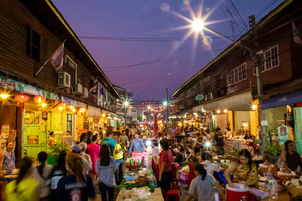
Trok Rong Ya Walking Street
Uthai Thani's weekend market along the old riverside lane — local food, antiques and handmade goods. The correct time to see the town's wooden shophouses at their most atmospheric.

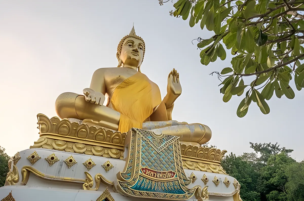
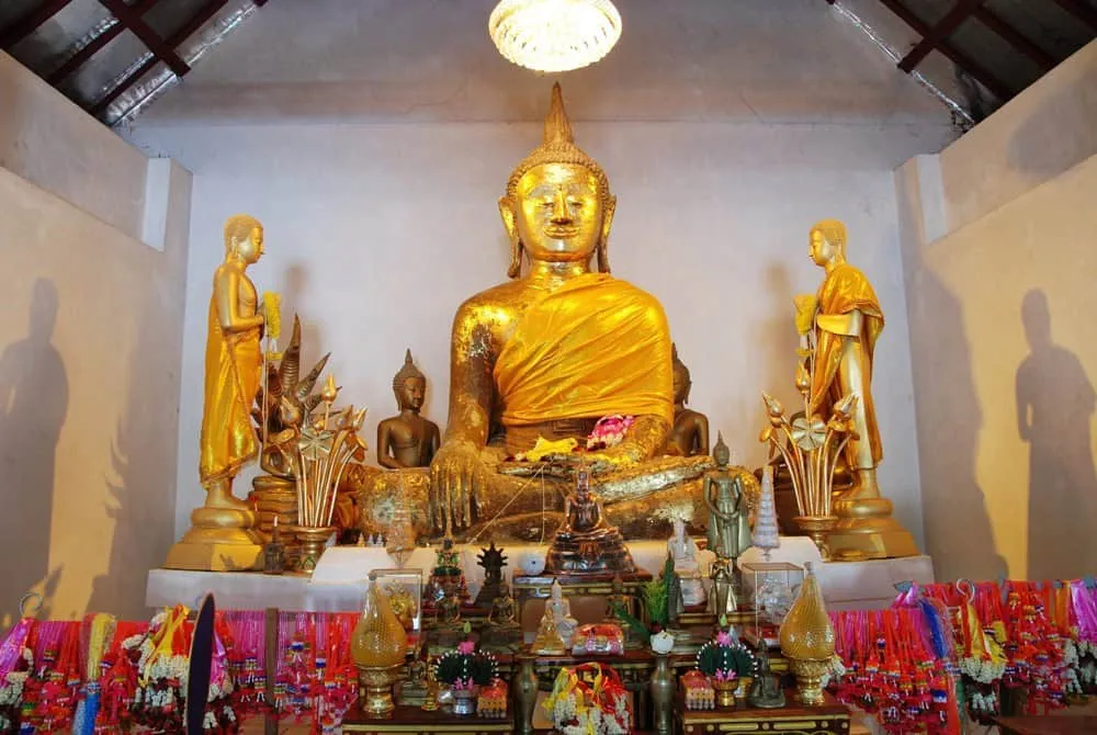
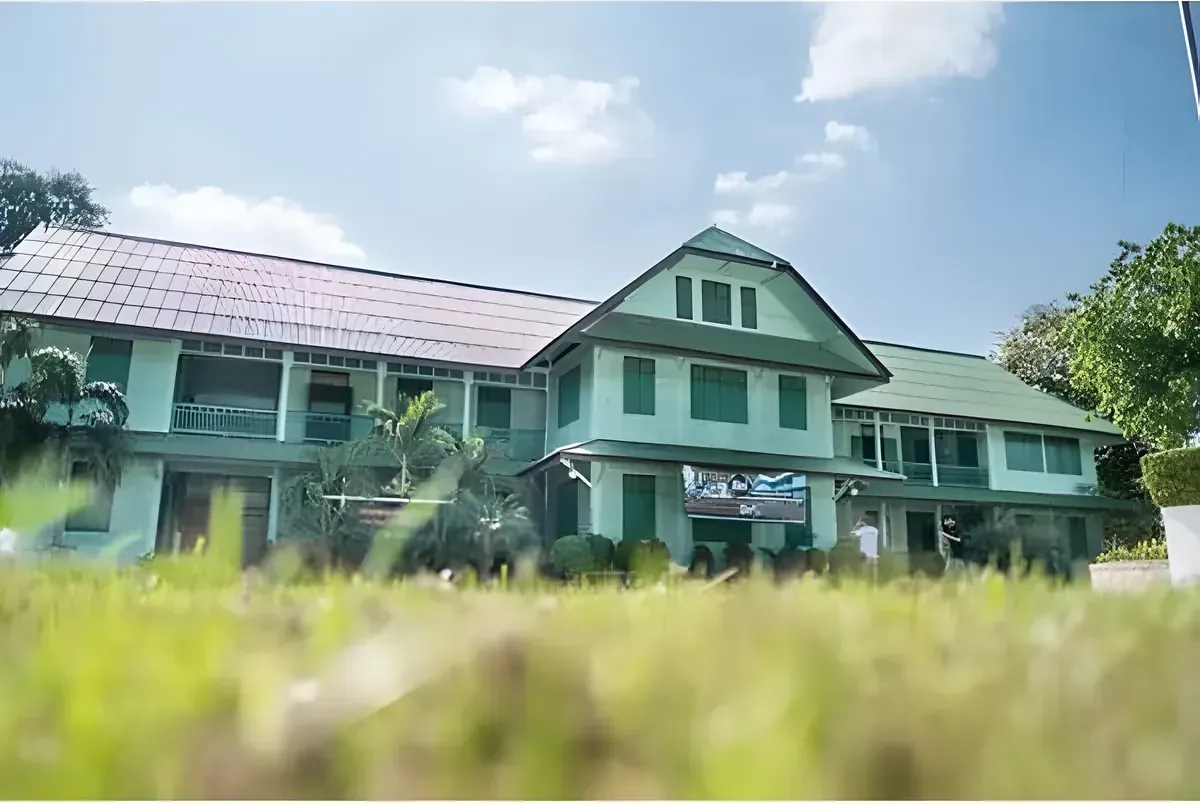
Luang Pho To Wat Phatung
The town's main temple on the hill above the river — the large seated Buddha and the staircase view over the Sakae Krang river are worth the climb.

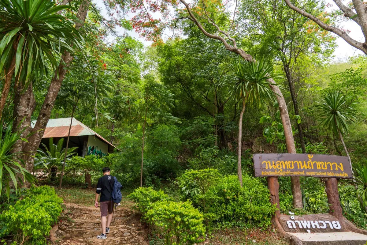
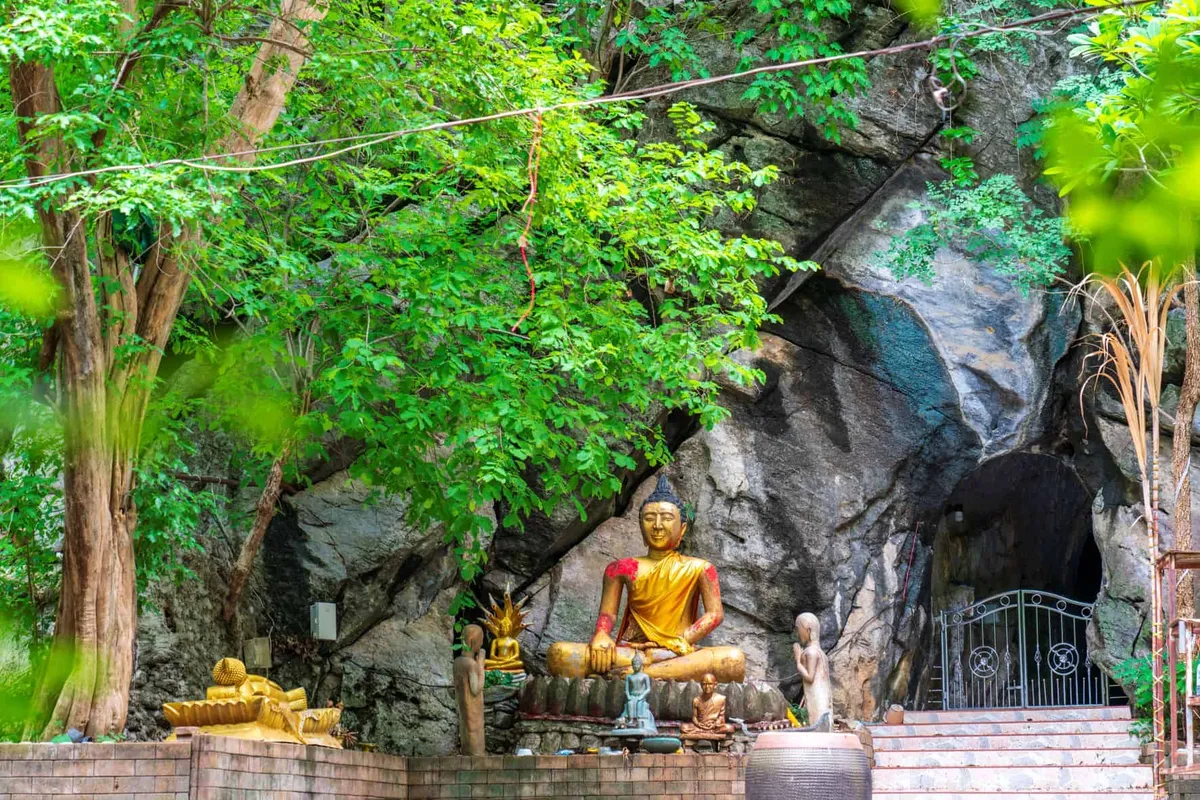
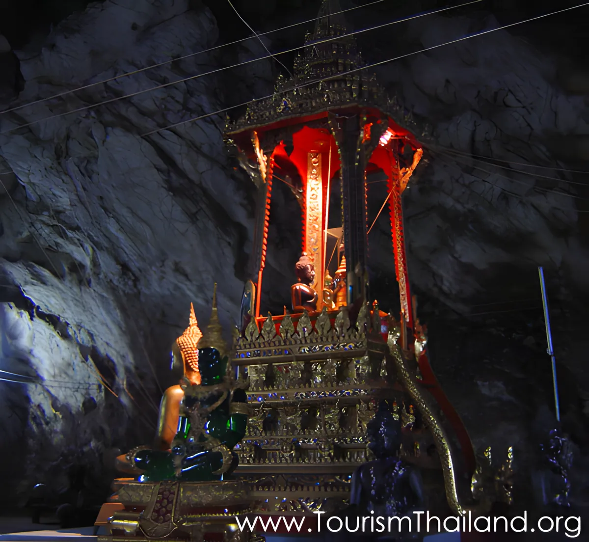
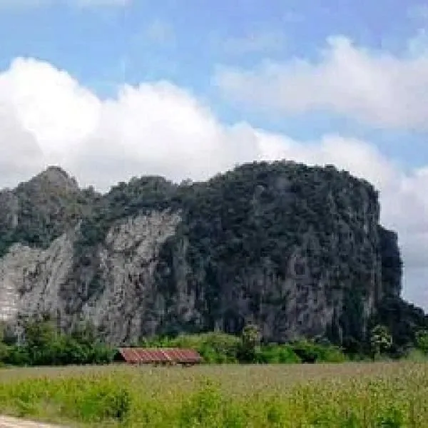
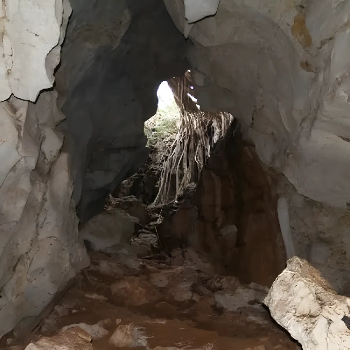
Tham Khao Wong Forest Park (Phu Wai Cave)
A cave temple complex inside a forested limestone hill — bats, shrines and a cool interior make it a good midday stop. Entry by donation.
Get to Uthai Thani
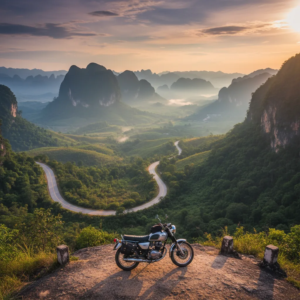
Buses from Bangkok's Mo Chit terminal reach Uthai Thani in around 3–4 hours — a manageable day trip or a natural stop on a route north to Sukhothai.

eSIM for Thailand
Land with data already working and skip the airport SIM queue. We tested six plans — code THAIHOLIDAY saves 10%.

Travel insurance
Trekking in the Huai Kha Khaeng wildlife corridor is remote — sort cover before you go and check wilderness hiking is included.
Wats, shrines & spiritual sites
Temples in Uthai Thani


Waterfalls, peaks, caves & parks
Nature & outdoors around Uthai Thani


Museums, history & heritage
Museums & culture in Uthai Thani


Things to do on the map
Tap a pin for details — 40 places in Uthai Thani plotted.
When to go
Nov–Feb The dry cool season is the best window for all sightseeing — comfortable temperatures, clear skies for forest walks, and the best conditions for birdwatching around Huai Kha Khaeng.
Mar–May Hot on the central plains before the rains break — temperatures can exceed 40°C by April. The hilltop temple at Khao Sakae Krang is worth an early morning start; the Sakae Krang river town is pleasant at dawn before the heat sets in.
May–Oct Monsoon season, with the heaviest rainfall in August and September. Waterfalls in Phu Toei National Park are at full flow from September to December. Town sights remain accessible; rural forest roads can flood.
About Uthai Thani
Last updated July 2026
Overview
Uthai Thani sits on the Sakae Krang River about 220 kilometres northwest of Bangkok, at the point where Thailand’s central plains begin to buckle into the forested hills of the western border range. It is one of the country’s least-visited provinces despite holding a UNESCO World Heritage site, a genuinely extraordinary temple, and a river town with a character that has changed little in a century.
The province was formally established in 1898 under King Rama V, though the settlement at Ban Sakae Krang is considerably older — the town claims direct ties to the founding of the Chakri dynasty, and a statue of King Rama I’s father stands inside Wat Sangkat Rattana Khiri on the hill above the river. Most visitors who do come are Thai: weekending families from Bangkok, birdwatchers with permits for the sanctuary edge, and domestic travellers drawn by the famous mirror temple about ten kilometres south of town.
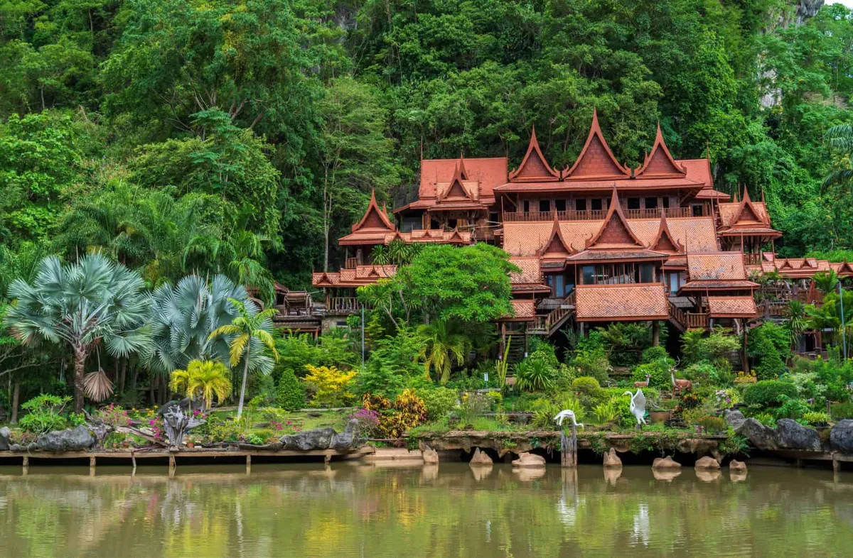
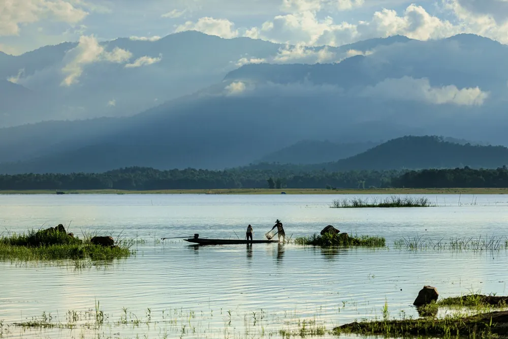
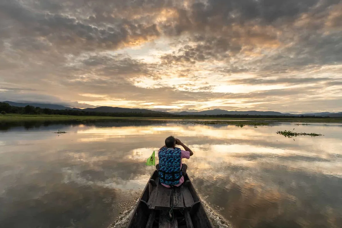
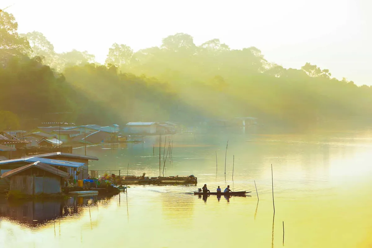
What holds the province together is the river. The Sakae Krang runs through the centre of Uthai Thani town and the old raft-house community that still lines its banks gives the place a rhythm you won’t find in more developed destinations. Early morning along the river — fishing boats, the occasional monk crossing by boat to receive alms at Wat Uposatharam on the far bank — is the image the town wants to leave you with.
Top Things to Do
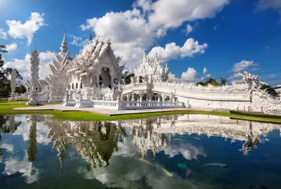
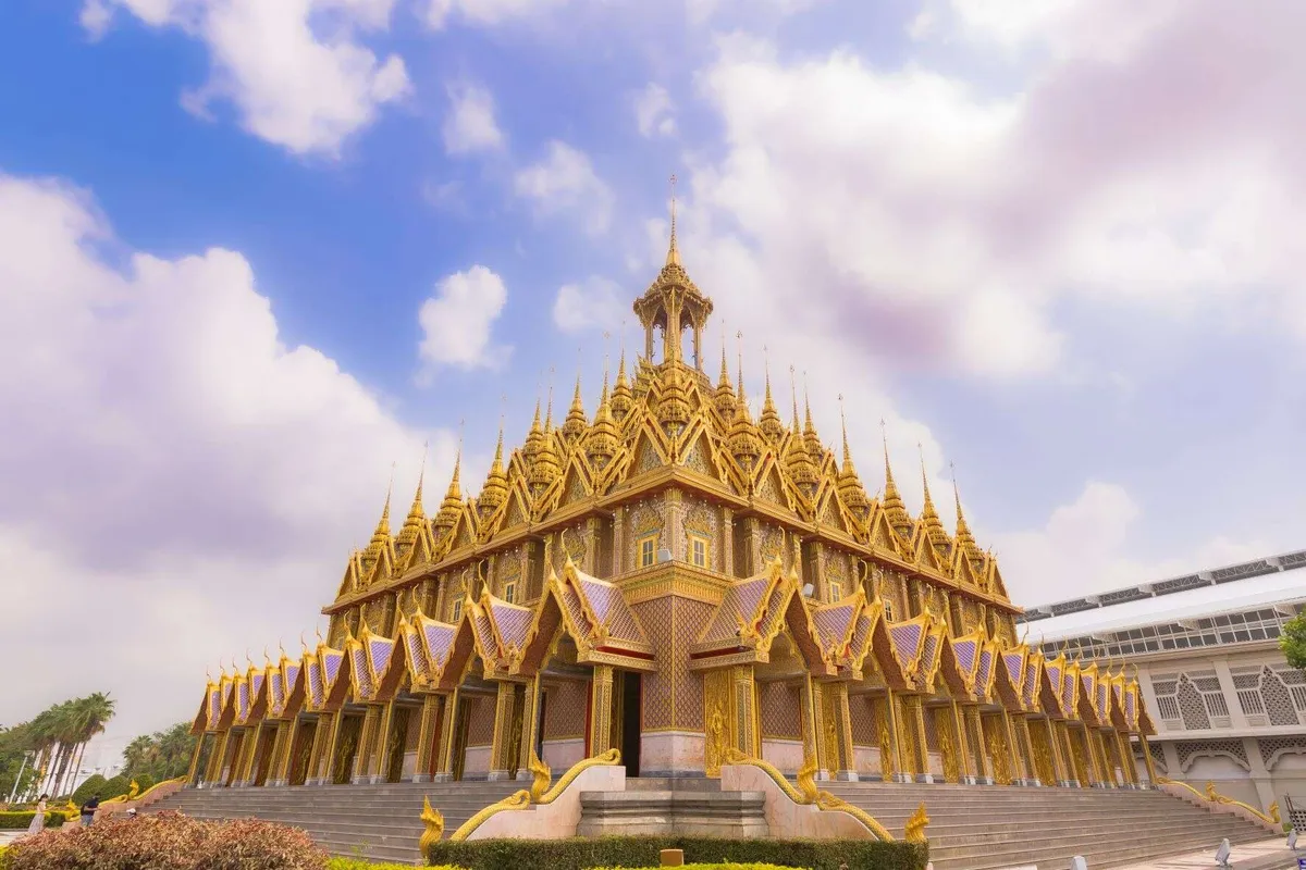
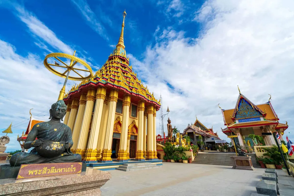
Wat Tha Sung (Wat Chantharam) is the province’s most-photographed sight and for good reason. The ordination hall is said to be around a hundred metres long and is covered inside and out with mirrored glass tiles — walls, columns, and ceilings all reflect in fractured light. The effect is unlike any other temple in Thailand. The building was renovated from a near-ruin starting in 1968, when Luang Phor Ruesi Lingdam became abbot and transformed the site into one of the country’s foremost meditation centres. The temple stands about ten kilometres south of town on the west bank of the river. Entry is free.
Sakae Krang River raft houses line the riverfront through the centre of Uthai Thani town. The community is considered one of the most intact floating communities in Thailand — families living in wooden houses mounted on rafts, raising fish in submerged cages, drying gourami on bamboo frames above the water. Local boatmen offer short river rides (30 to 45 minutes) from near Wat Sangkat Rattana Khiri. There are also a handful of raft-house homestays and guesthouses on the water if you want to stay overnight.
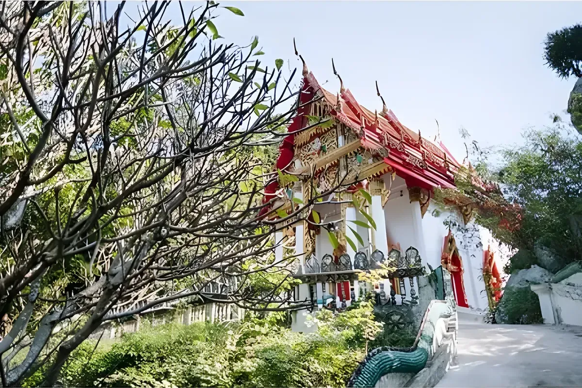
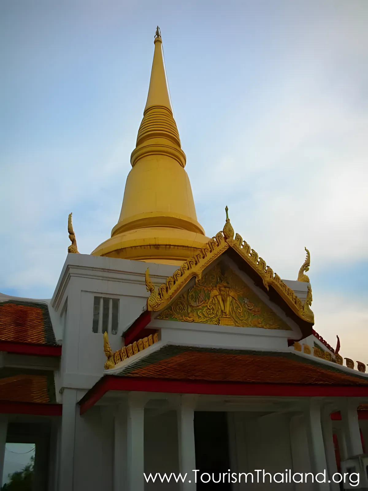
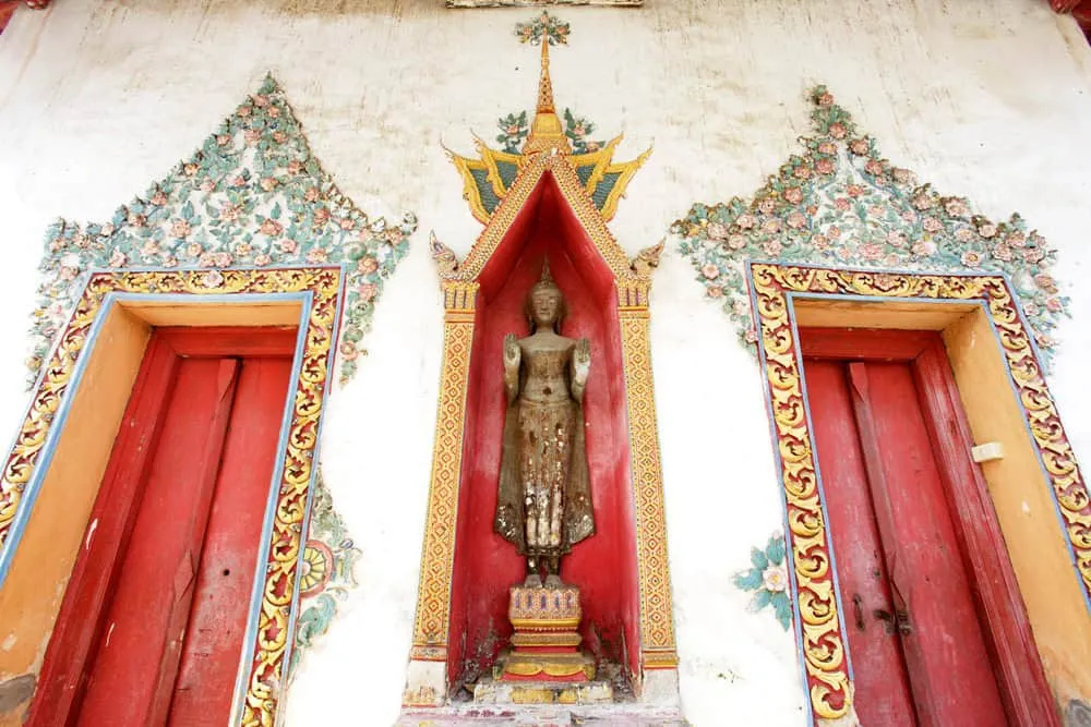
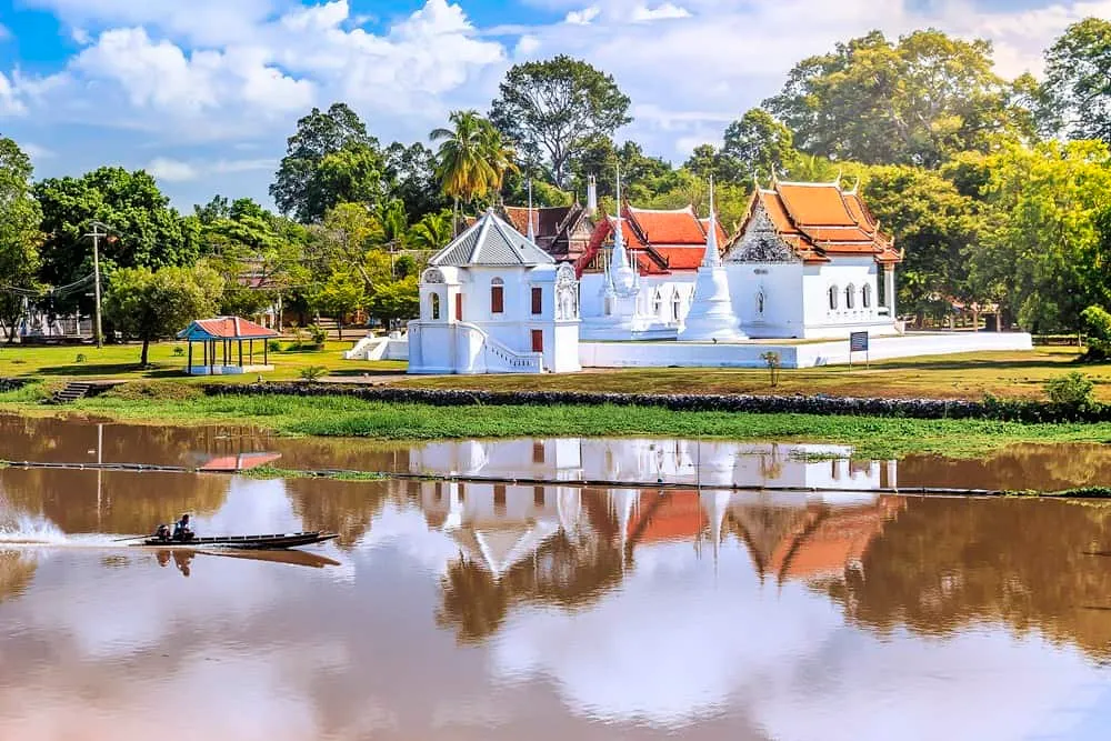
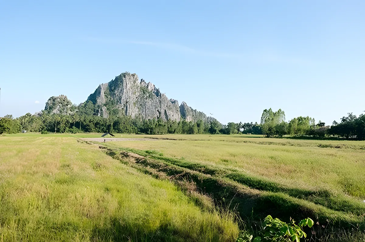
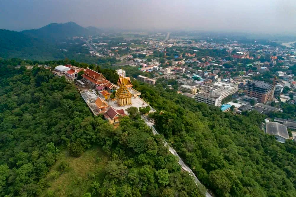
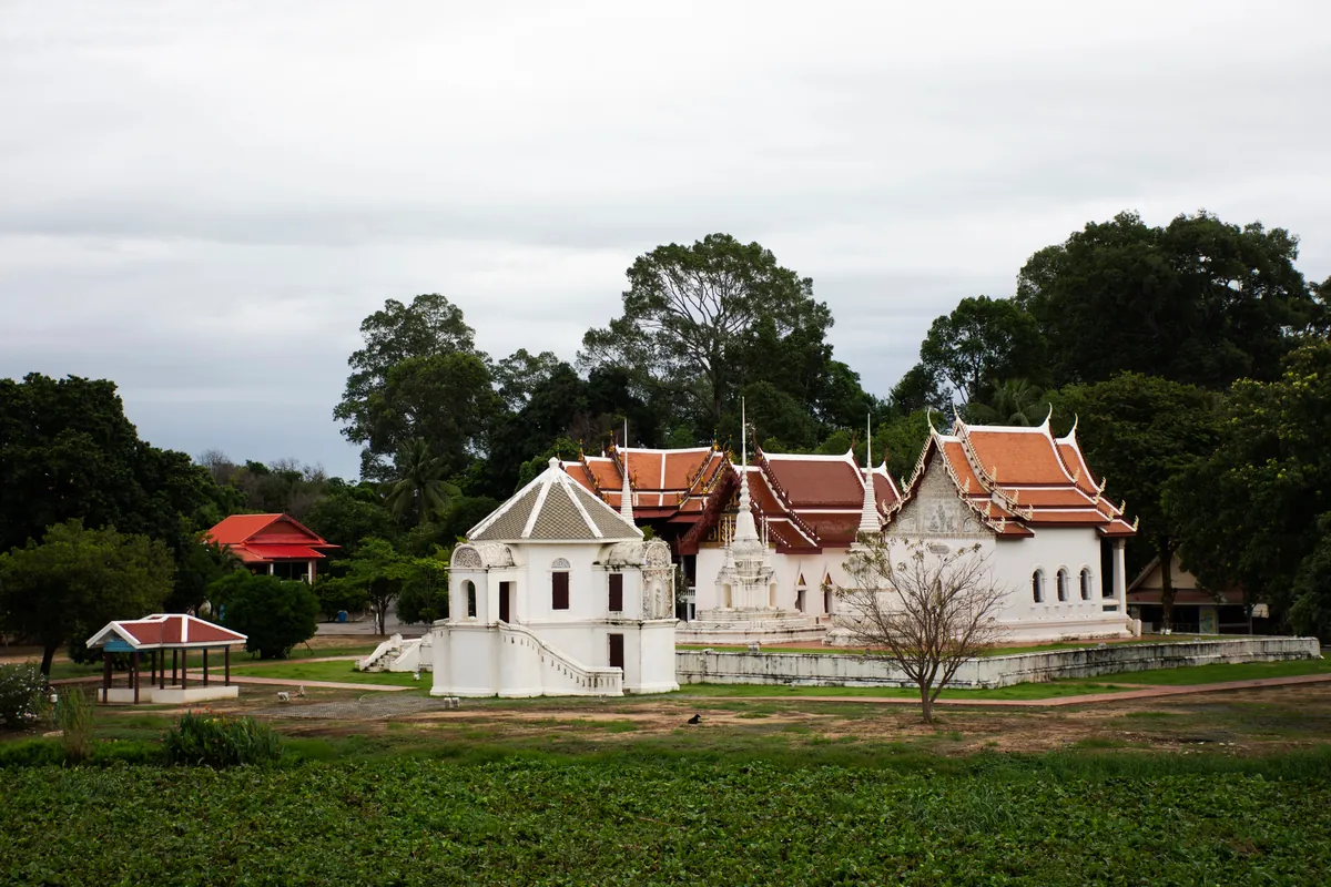
Wat Sangkat Rattana Khiri occupies Khao Sakae Krang hill, the limestone outcrop that rises above the old town. The lower temple is calm and accessible; the upper section requires a climb of 449 steps up a Naga staircase, but the views over the river bend and the town’s corrugated rooftops from the hilltop pavilion justify the effort. The temple holds an ancient bronze Buddha in the Sukhothai style, and Uthai Thani’s most important Tak Bat Thewo ceremony takes place here each year after the end of Buddhist Lent.
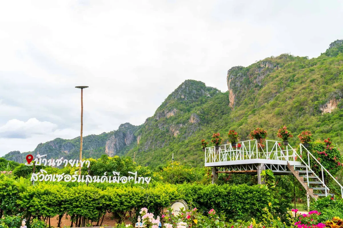
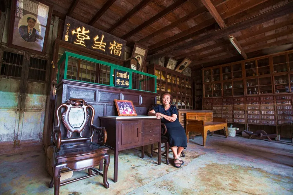
Trok Rong Ya is the old trading lane that runs through the town’s riverside quarter — a street of wooden shophouses more than a hundred years old, built by Chinese traders who ran the river commerce. The name refers to the district’s history as a licensed opium area; the economic history is layered into the architecture. Today the lane has cafes, small antique shops, and local restaurants, but the wooden buildings remain in original condition and the 700-metre stretch gives a clear sense of what a provincial river town looked like in the early 20th century.
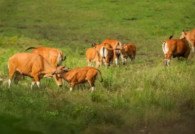
Huai Kha Khaeng Wildlife Sanctuary covers 2,780 square kilometres across Uthai Thani, Tak, and Kanchanaburi provinces and was jointly inscribed with Thung Yai Naresuan as UNESCO World Heritage in 1991. Together, the two sanctuaries form the largest intact block of seasonal tropical forest in mainland Southeast Asia, home to tigers, elephants, gaur, and an exceptional range of bird species. Casual day trips into the interior are not permitted — the sanctuary is a restricted research and protection area. The Seub Nakhasathien Memorial near the sanctuary headquarters is accessible without permits and is worth the detour: it commemorates the wildlife officer who took his own life in 1990 after years fighting poaching and corruption, and whose death catalysed Thailand’s modern conservation movement. Specialist birdwatching groups can obtain advance permits for guided visits to the sanctuary’s outer zones.
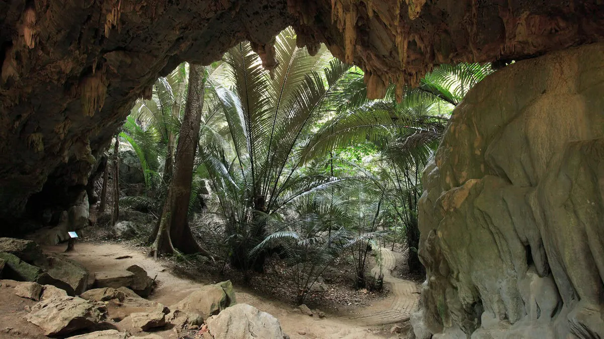
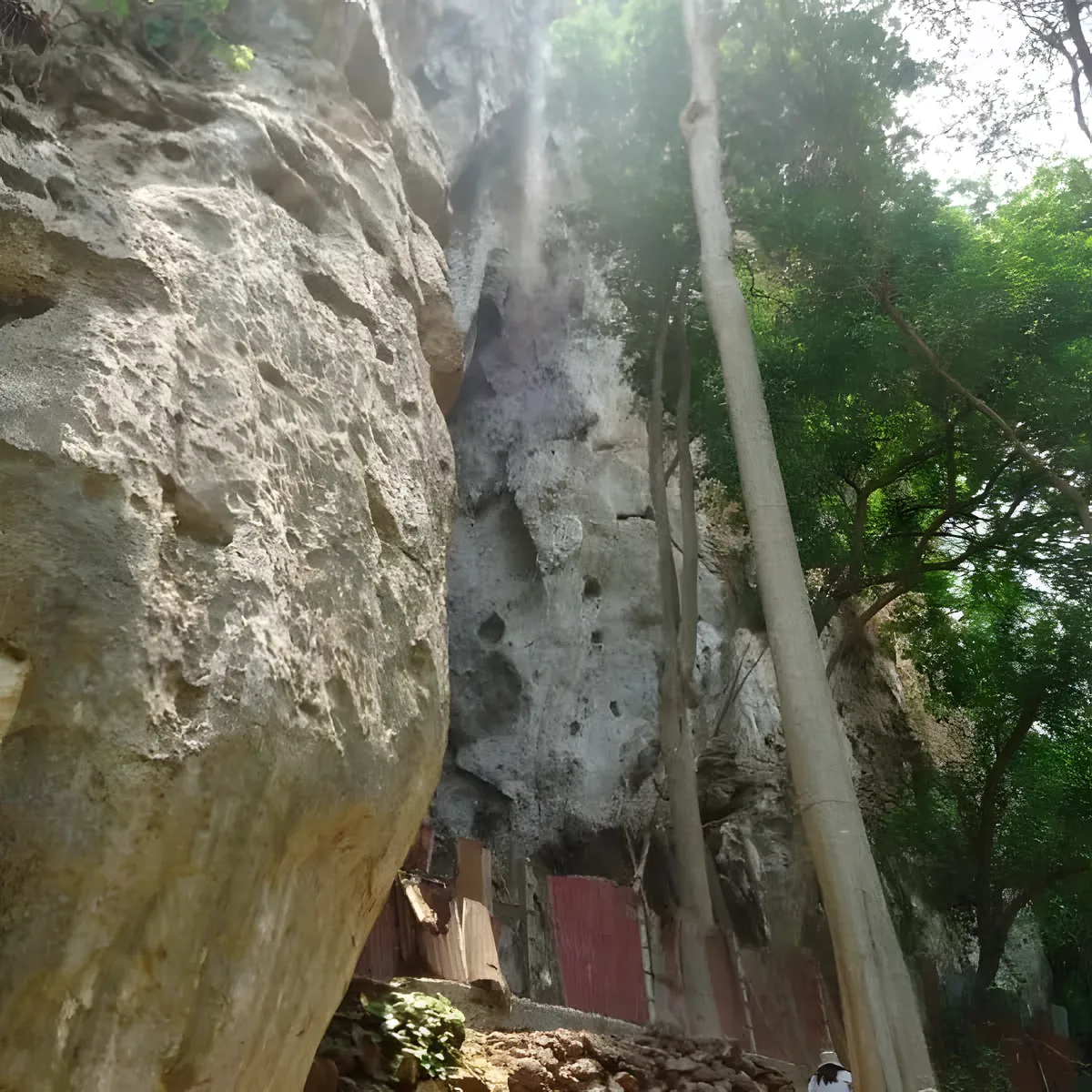
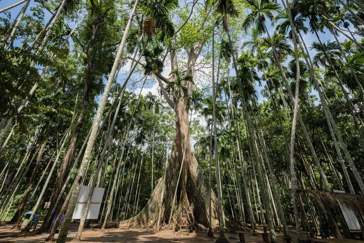
Hup Pa Tat is a collapsed limestone cave whose sunken floor has been colonised by giant fishtail palms (Arenga westerhoutii) — a relic species of ancient tropical forest rarely found at this latitude. The Royal Forest Department has protected the site as a conservation area. A 700-metre round-trip trail passes through the valley, with a torch useful for the cave entrance section. The atmosphere — cool, dim, palms rising to 20 metres in a limestone bowl — is genuinely unlike anything in the region. The site is in Ban Rai district, about an hour from town.
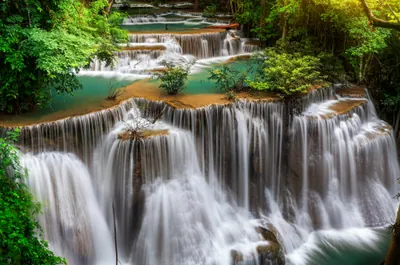
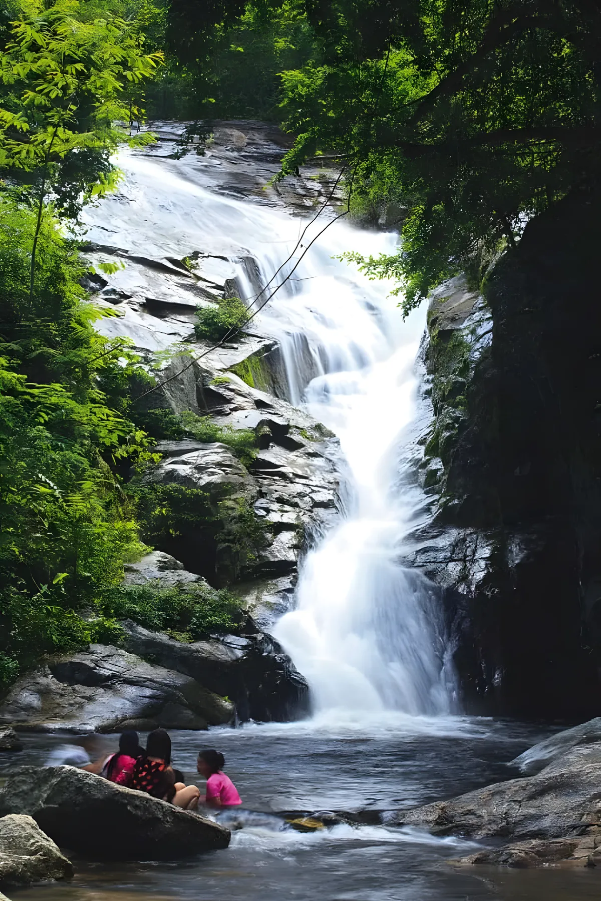
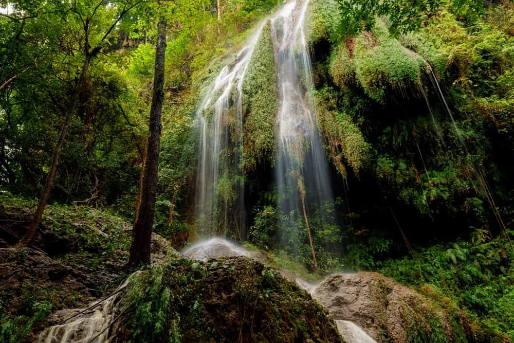
Phu Toei National Park straddles the Uthai Thani and Suphanburi border and has several waterfalls, including Namtok Taphoen Khi near the Karen village of the same name. The park’s waterfalls are best visited September through December when the monsoon runoff keeps them at full flow. The park is more accessible than Huai Kha Khaeng and a good option if you want forest walking without permit requirements.
Where to Stay
Uthai Thani town has a small but growing selection of hotels and guesthouses, anchored by the old town quarter near Trok Rong Ya. The Avartarn Miracles Hotel is the current top-end option; mid-range choices include Uthai Heritage Hotel in the centre of town and Green House Resort Praduyuen a short drive out. Staying on a raft house is an option worth considering — a handful of operators offer overnight stays on the river, including the Sakae Krang Floating House. There are no international chain hotels and no beach resorts; this is a destination for travellers who want a real town with a real pace of life.
Getting There
Buses from Bangkok’s Mo Chit Bus Terminal run directly to Uthai Thani, with the journey taking around three hours. There is no direct train connection — Uthai Thani is not on the main northern railway line. By car, take Highway 1 north to Nakhon Sawan and branch west on Highway 3005; the driving distance is approximately 220 kilometres. Minivan services from Bangkok are available and slightly faster than the ordinary bus.
Within the province, a hired driver or your own vehicle is necessary for anywhere beyond the town centre. Distances are not huge but public transport connections to Hup Pa Tat, Wat Tha Sung, and the Huai Kha Khaeng area are limited.
Best Time to Visit
Uthai Thani follows the central and western Thailand pattern: the wet season runs May through October, with the heaviest rainfall in August and September. November through February is the dry cool season and the most comfortable window for all activities — river life, temple touring, and any excursion towards the forested western hills. March and April are hot, with temperatures regularly above 38°C on the plains; early morning starts help if you’re visiting the hilltop temple or walking at Hup Pa Tat.
The province doesn’t have the extreme burning-season haze that affects northern Thailand, so smoke is not a significant factor in the visitor calendar. Waterfalls in the national park come into their own from September through December as the monsoon runoff builds, which means the end of the wet season into the early dry is worth noting for anyone specifically interested in Phu Toei.
Frequently Asked Questions about Uthai Thani
How do I get to Uthai Thani from Bangkok?
What is the best time of year to visit Uthai Thani?
How long do you need in Uthai Thani?
Can I visit Huai Kha Khaeng Wildlife Sanctuary?
How do I get around Uthai Thani?
Plan your
Uthai Thani trip