Khao Ta Mong Lai Forest Park
วนอุทยานเขาตาม่องล่าย
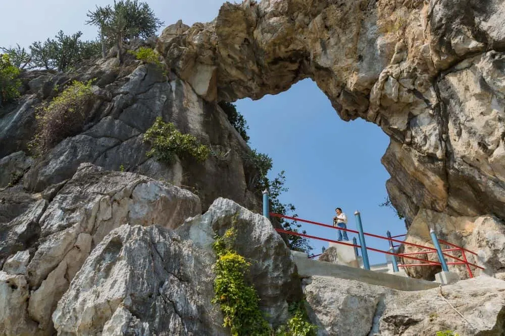
Khao Ta Mong Lai is a forest park on a limestone ridge in Ao Noi subdistrict, on the edge of Prachuap Khiri Khan town, not a national park, but a smaller wanoutthayan classification covering around 862 rai. Entry is free, and the main viewpoint is an easy 200-metre walk from the entrance.
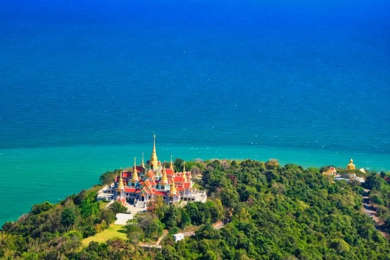
The ridge itself is unusual: two connected limestone hills rising 290-320 metres, with most of the range dropping straight into the Gulf of Thailand as steep cliffs rather than sloping down to a beach. That geology is what makes the short walk worthwhile: from the viewpoint platform you look straight down over Prachuap Bay and the town, with open water on both sides of the headland. The forest along the trail is dry-evergreen, mixed with smaller trees, and shelters wildlife including cliff-dwelling langurs, gibbons, and wild boar, though sightings on a short visit are hit or miss.
Unlike many of Thailand’s forest parks, this one has real facilities: a camping ground, a cafe, and accommodation on-site, which makes it workable as a low-key overnight stop rather than purely a day-trip detour. The rocky shoreline below the ridge isn’t a swimming beach, but it’s a quiet spot for photos and for watching the sun go down over the bay.
Insider Tip: The short walk to the viewpoint means this works well as a sunset stop before dinner in Prachuap town. You don’t need to plan around it as a half-day excursion the way you might for a bigger hike.
Watch out: “Forest park” doesn’t mean untouched wilderness here. It’s a compact, well-visited local spot rather than a remote wilderness hike, so don’t expect the solitude of a larger national park.
- Classification: Forest park (วนอุทยาน), roughly 862 rai, not a national park
- Terrain: Limestone ridge, 290-320 m, cliffs dropping to the Gulf of Thailand
- Main trail: About 200 m to the viewpoint, easy grade
- Entry: Free
- Facilities: Camping ground, cafe, accommodation on-site
Pair a visit with Khao Chong Krachok, Prachuap’s other hilltop viewpoint on the opposite side of town, or Ao Manao for the beach the ridge overlooks from above.
Location & Directions
Mueang Prachuap Khiri Khan, Prachuap Khiri Khan
Prachuap Khiri Khan, Thailand
Show your taxi or Grab driver
วนอุทยานเขาตาม่องล่าย
Frequently Asked Questions
Is Khao Ta Mong Lai a national park?
How far is the viewpoint from the entrance?
What can you see from the top?
Is Khao Ta Mong Lai free to visit?
Can you camp at Khao Ta Mong Lai?
Spotted something out of date or incorrect? Let us know
Stay Near Khao Ta Mong Lai Forest Park
Live prices for places closest to Khao Ta Mong Lai Forest Park: tap a pin to compare.