Chao Phraya Sky Park
สวนลอยฟ้าเจ้าพระยา
Chao Phraya Sky Park is a free, 280-metre elevated pedestrian and cycling bridge built on the abandoned viaduct of Bangkok’s cancelled Lavalin Skytrain project. It runs alongside Memorial Bridge, linking the Phra Nakhon and Thonburi riverbanks, and opened in June 2020 as Thailand’s first sky park. It’s open daily, 05:00-20:00.
Experience
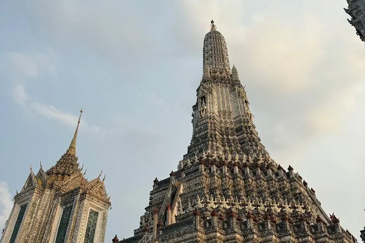
The path holds three named viewpoint plazas along its length: Lan Arun Rung near the Phra Nakhon end, Lan Jai Chao Phraya at the midpoint over the river, and Lan Tawan Ron on the Thonburi side. From the deck (8.5 metres wide and standing about 9 metres above the water) you get a 360-degree view taking in Memorial Bridge, the temple spires and shophouses of old Charoen Krung, and Wat Arun’s prang across the river. Planting runs the length of the path, softening what was three decades of bare concrete left over from the failed skytrain project: construction was contracted in 1990 and abandoned in 1992 after the Lavalin consortium ran into funding trouble, leaving only the central span standing until the park’s 2020 conversion.
Atmosphere & Timing
Access on the Phra Nakhon side sits near Pak Khlong Talat, Bangkok’s flower and produce market, and on the Thonburi side near Khlong San and ICONSIAM. Locals use it for morning and evening exercise (walking, jogging, and cycling) more than as a sightseeing stop, so early morning and early evening are the busiest windows. The exposed steel-and-concrete deck has no shade, which makes midday crossings uncomfortably hot for most of the year.
Insider Tip: Time a visit for Lan Tawan Ron at the Thonburi end around sunset. Wat Arun’s prang catches the last light directly across the water from this plaza.
Watch out: There’s no shade anywhere on the bridge. Cross in early morning or after about 16:00 rather than at midday, especially in the hot season (March-May).
Practical
- Entry fee: Free
- Hours: Daily 05:00-20:00
- Length: 280 metres (8.5m wide, roughly 9m above the river)
- History: Built on the abandoned viaduct of the 1990s Lavalin Skytrain project
- Opened: June 2020
Chao Phraya Sky Park is located at Phra Nakhon, Bangkok, within walking distance of Wat Arun on the Thonburi side and the Pak Khlong Talat Night Market on the Phra Nakhon side. View on Google Maps.
Location & Directions
Phra Nakhon, Bangkok
Bangkok, Thailand
Show your taxi or Grab driver
สวนลอยฟ้าเจ้าพระยา
Frequently Asked Questions
Is Chao Phraya Sky Park free?
What was here before the park?
How long is the bridge?
Can you see Wat Arun from the park?
How do you get to Chao Phraya Sky Park?
Spotted something out of date or incorrect? Let us know
Popular tours in Bangkok





Stay Near Chao Phraya Sky Park
Live prices for places closest to Chao Phraya Sky Park: tap a pin to compare.