


Doi Pha Tang
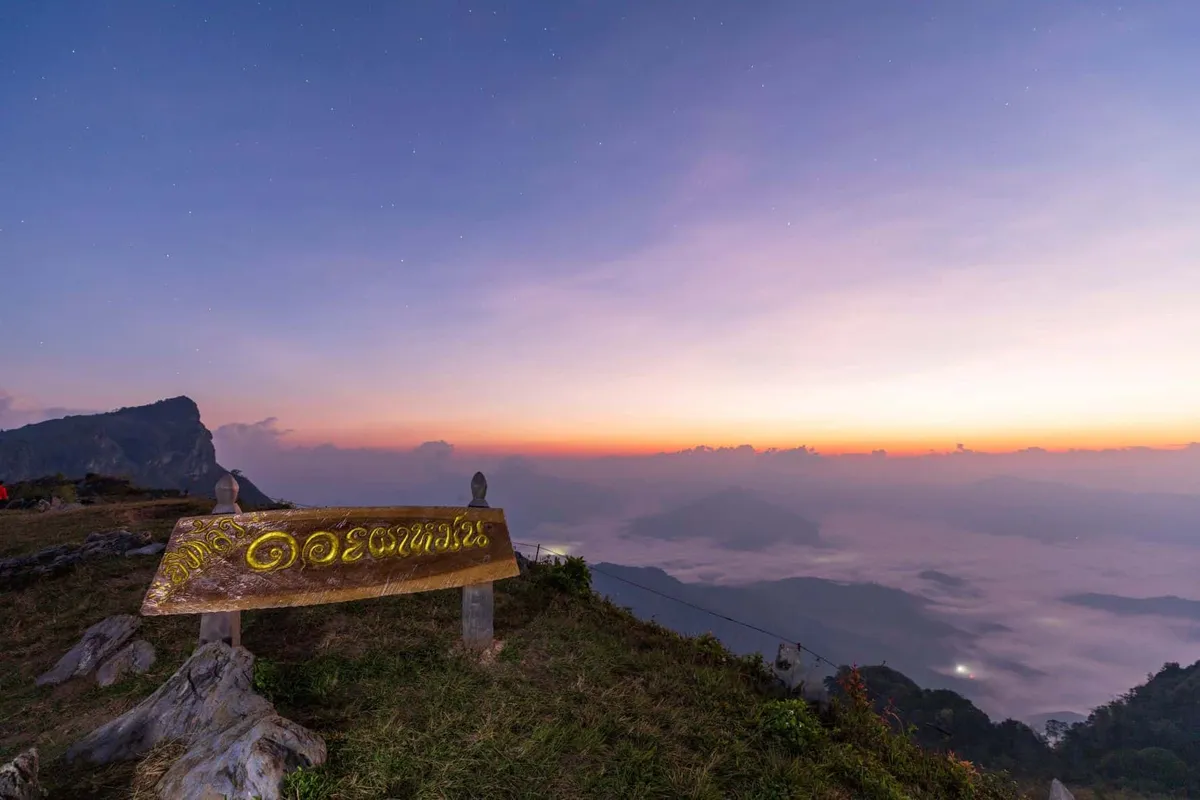
ดอยผาตั้ง
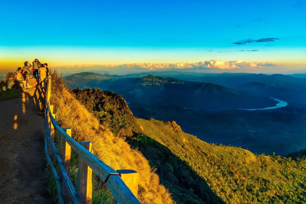
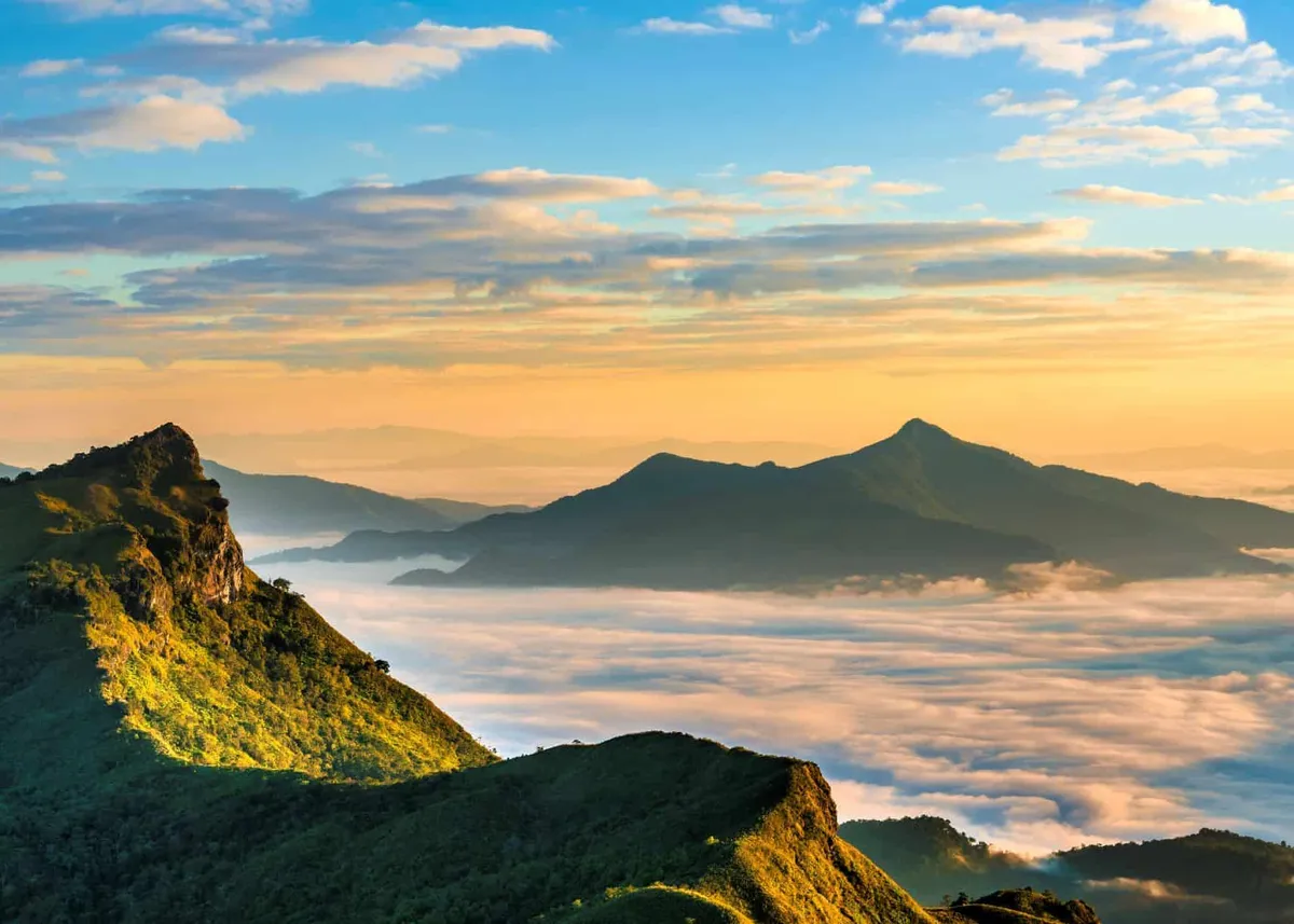
Doi Pha Tang is a separate ridge from the better-known Phu Chi Fa, about 25km away in the same corner of Chiang Rai’s Wiang Kaen district — worth knowing before you book, since the names get confused online. Its centrepiece is a natural stone gap in the cliff edge that frames a clean view down onto the Mekong River as it curves through Laos. From there, a roughly 1km walk — steep and uneven in stretches — climbs to a second viewpoint, and a further ridge point beyond that opens onto a 360-degree panorama of grassy hilltop and scattered boulders at around 1,570m.
The draw here is the same sea of mist that makes northern Thailand’s ridges famous, minus the crowds that build up at Phu Chi Fa. Cool season mornings (November to February) bring fog pooling in the valleys below while the ridge itself sits in clear air and early light. In the same window, wild Himalayan cherry blossoms (nang phaya suea khrong) flower along the trail, giving the walk a burst of pink against the grass and rock. Because the site is less trafficked than its famous neighbour, you can often have a viewpoint largely to yourself even during peak sunrise hour.
Reaching the ridge for sunrise takes planning. The village of Ban Pha Tang, where most visitors base themselves overnight, sits below the viewpoints and has guesthouses, camping grounds, and simple restaurants. From the village, the final approach to the highest viewpoint is rough track rather than paved road, so a local 4WD pickup before dawn is the standard way up — walking it in the dark isn’t realistic if you want to catch first light. Camping isn’t permitted on the ridge itself, only down in the village.
Insider Tip: Arrange your 4WD pickup with your guesthouse the evening before — vehicles fill up fast in cool season, and turning up at 5am without a booking often means missing the best light.
Watch out: The path between viewpoints has loose gravel and a short rock scramble near the top — sturdy shoes matter more here than at most northern Thailand viewpoints, and it’s not a stroller-friendly route.
- What it is: Ridge-top viewpoint on the Luang Prabang Range, the Thailand-Laos border
- Elevation: Around 1,600-1,800m; ridge viewpoints run to roughly 1,570m
- Main features: A natural stone gap framing the Mekong, plus two higher numbered viewpoints
- Distance: About 160km from Chiang Rai town; roughly 25km from Phu Chi Fa
- Entry: Free, daily 05:00-18:30
Doi Pha Tang sits within the wider Phu Chi Fa area, so it pairs naturally with a Phu Chi Fa sunrise trip on a different morning, or with the quieter ridge at Phu Chi Dao if you want a third mist-viewing spot without doubling back on the same road.
Good to Know
Good for
On site
Location & Directions
17, Moo14, Po, Wiang Kaen District, Chiang Rai 57310
Phu Chi Fa, Thailand
Show your taxi or Grab driver
ดอยผาตั้ง
Frequently Asked Questions
Is Doi Pha Tang the same place as Phu Chi Fa?
What's the actual view from Doi Pha Tang?
Is there an entry fee?
Can I camp at Doi Pha Tang?
How do I get to Doi Pha Tang for sunrise?
Hotels Near Doi Pha Tang
Live prices around the attraction — tap a pin to compare.