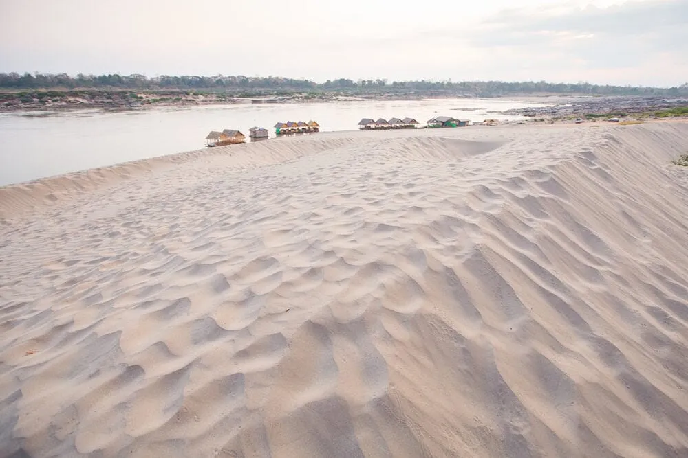
Hat Salueng is a dry-season sandbar on the Mekong River in Pho Sai district, Ubon Ratchathani province, about 115 km from the provincial capital near Ban Song Khon. When the river runs low, roughly November to May, a long stretch of pale sand emerges along the bank, with the hills of Laos visible across the water. During the rainy season, rising water covers most or all of it, so this isn’t a beach you can count on visiting in July. Entry is free.
The appeal here is the contrast: fine river sand instead of ocean coastline, calm shallows instead of surf, and a crowd that’s almost entirely Thai families rather than international tourists. People wade and swim near the bank, though the current picks up further out and there’s no lifeguard cover. Treat depth and current with the same caution you’d give any river, not a resort pool. From Hat Salueng, boat trips run to Pak Bong, the narrowest stretch of the Mekong along Thailand’s border with Laos, just 56 metres wide, where fishermen work the water with large bamboo scoop nets.
Insider Tip: Combine it with Sam Pan Bok, about 7 km away: both are dry-season river features in the same stretch of Pho Sai, and pairing them makes better use of the drive out from Ubon city.
Watch out: Don’t plan a dedicated trip here without checking the season first. During the rains, the sandbar can be entirely underwater and there’s nothing to see.
- Entry: Free
- Best season: Roughly November-May, when low water exposes the sandbar
- Location: Ban Song Khon, Pho Sai district, ~115 km from Ubon Ratchathani city
- Nearby: Pak Bong (narrowest point of the Mekong) and Sam Pan Bok, ~7 km away
- Facilities: Basic food stalls near the parking area; no lifeguards
Basic food stalls near the parking area serve grilled fish and simple dishes, but there’s little shade beyond a few bankside trees, so bring your own water and sun protection. Pair the visit with two other seasonal Mekong sandbars in the same province, Hat Wat Tai and Hat Sai Sung, for a fuller picture of how this stretch of the river changes through the year.
Location & Directions
Pho Sai, Ubon Ratchathani
Ubon Ratchathani, Thailand
Show your taxi or Grab driver
หาดสลึง
Frequently Asked Questions
Is Hat Salueng a beach all year round?
How far is it from Ubon Ratchathani city?
Is there an entry fee?
Can you swim there?
What else is there to do besides the beach?
Spotted something out of date or incorrect? Let us know
Stay Near Hat Salueng
Live prices for places closest to Hat Salueng: tap a pin to compare.