Khao Phang Hoei Viewpoint
จุดชมวิวเทือกเขาพังเหย
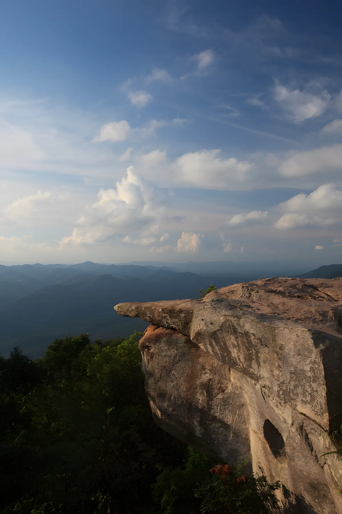
Khao Phang Hoei Viewpoint is a roadside pull-off on Highway 225 at roughly the km 70 marker, sitting at 1,008 metres, the highest point of the Phang Hoei range, on the ridge dividing Chaiyaphum’s Phakdi Chumphon district from neighbouring Phetchabun province. Pull off the highway, park by the vendor stalls, and the land drops away toward Phetchabun’s plains below.
There’s no ticket gate here: it’s a public highway shoulder rather than a managed park entrance, even though it sits on the same ridge as Sai Thong National Park and gets listed alongside the park’s other viewpoints and waterfalls. A short nature trail runs along the ridge from the main parking area, and a few local vendor stalls sell snacks and drinks to passing traffic. The elevation keeps the air noticeably cooler than the valley floor below, which is part of the draw for Thai visitors chasing a rare taste of chilly weather without leaving the region.
Insider Tip: aim for late afternoon. The Phetchabun plains spread out below in full view as the sun drops, and the ridge catches golden light that the flat lowlands below miss. Early morning can bring mist pooling in the valleys, but visibility is less reliable than at sunset.
Watch out: there’s nothing here beyond the viewpoint itself and a couple of snack stalls: no restrooms, no shade shelter, and no phone signal guarantee. Bring water and a layer for the wind, and don’t count on finding fuel nearby; fill up before you leave Chaiyaphum town or the Highway 225 route toward Phetchabun.
Because it’s a drive-up stop rather than a hiking destination, most visitors spend 15-30 minutes here, enough for photos and a walk along the ridge trail, before continuing toward Pha Sut Phaen Din Viewpoint or the waterfalls inside Sai Thong National Park itself, both a short drive further along the same route.
- Elevation: 1,008m, the highest point of the Phang Hoei range
- Location: Highway 225, around the km 70 marker, Phakdi Chumphon district
- Fee: Free, a roadside stop, not a ticketed park entrance
- Best time: Late afternoon for the clearest views over the Phetchabun plains
- Access: Car or motorbike only; no public transport reaches the ridge
Location & Directions
Phakdi Chumphon, Chaiyaphum
Chaiyaphum, Thailand
Show your taxi or Grab driver
จุดชมวิวเทือกเขาพังเหย
Frequently Asked Questions
Is there an entrance fee?
How do I get there?
Is this the same as Sai Thong National Park?
What's the best time to visit?
Are there facilities?
Spotted something out of date or incorrect? Let us know
Stay Near Khao Phang Hoei Viewpoint
Live prices for places closest to Khao Phang Hoei Viewpoint: tap a pin to compare.