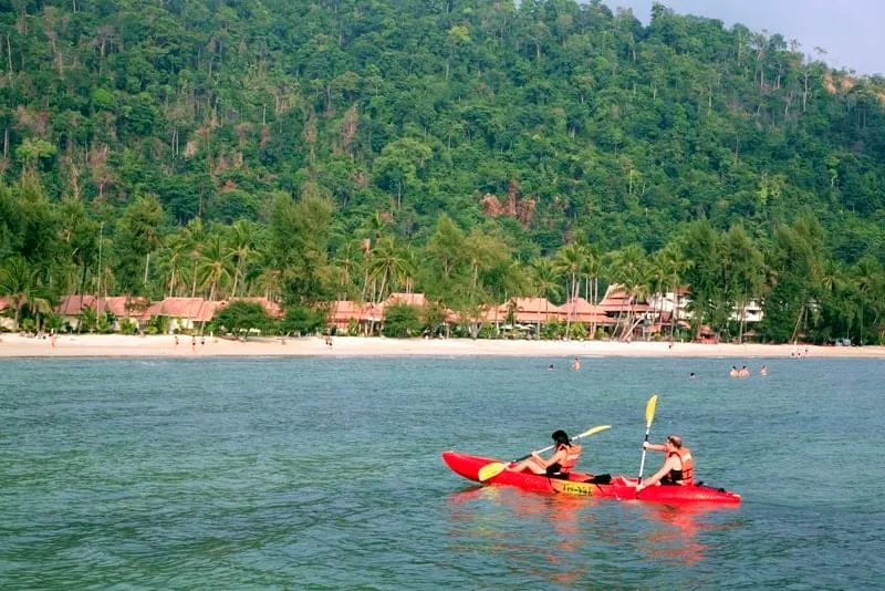





Ao Tan Khu is a small horseshoe bay on the Trat mainland, in Laem Ngop district, looking out across the water toward the northern tip of Koh Chang rather than sitting on the island itself. The name comes from a pair of coconut palms (“tan khu” means “a pair”) that once grew together in the middle of the beach. It’s a short drive from the piers that run ferries out to Koh Chang, which is why locals and TAT both file it under the island’s tourism area even though you don’t need a boat to reach it.
The bay is a few hundred metres of pale, fine sand, calm enough for swimming thanks to the sheltered curve of the shoreline, with water clear enough to see fish near the shallows. A handful of simple seafood restaurants and beachside shops sit along the sand. The seafood tends to come off boats that fish this same stretch of coast. Kayaks are available to rent for paddling the bay, and the beach has a reputation locally as a good sunset spot, facing west across the water. Coconut palms line parts of the shore for shade, though not the whole beach, so there are open stretches with no cover.
Insider Tip: Because most travellers heading to Koh Chang drive straight past on their way to the ferry pier, Ao Tan Khu stays a mostly Thai beach even in high season. Go if you want sand and quiet without crossing to the island.
Watch out: Facilities are basic and shade is patchy in the middle of the day. Bring water and sun protection, and don’t expect the beach bars or watersports rental you’d find on Koh Chang’s own beaches like Hat Sai Khao.
The beach sits in Bang Pit subdistrict, reached via Highway 3156, roughly a 10–15 minute drive from Laem Ngop’s ferry piers and around 25 minutes from Trat town. It works well as a stop before or after the ferry crossing rather than a dedicated day trip, and pairs naturally with a visit to the Koh Chang area beaches on the island proper, such as Hat Khlong Phrao.
- Entry fee: Free
- Location: Mainland Laem Ngop, Trat, not on Koh Chang island
- Coast: Gulf of Thailand
- Activities: Swimming, kayaking, sunset viewing, seafood restaurants
- Getting there: ~10–15 min from the Koh Chang ferry piers via Highway 3156
Location & Directions
Laem Ngop, Trat
Koh Chang, Thailand
Show your taxi or Grab driver
อ่าวตาลคู่
Frequently Asked Questions
Is Ao Tan Khu actually on Koh Chang island?
Where does the name Ao Tan Khu come from?
Is there an entrance fee?
Is it on the Gulf of Thailand or the Andaman Sea?
Spotted something out of date or incorrect? Let us know
Popular tours in Koh Chang




Stay Near Ao Tan Khu
Live prices for places closest to Ao Tan Khu: tap a pin to compare.