Bang Lang Dam
เขื่อนบางลาง
Bang Lang Dam is a clay-core rockfill dam on the Pattani River in Bannang Sata district, Yala, the first multipurpose hydroelectric project built in southern Thailand. The dam stands 85 metres high with a 430-metre crest, and its reservoir holds around 1,420 million cubic metres of water. Entry to the viewpoint is free, daily 06:00-18:00.
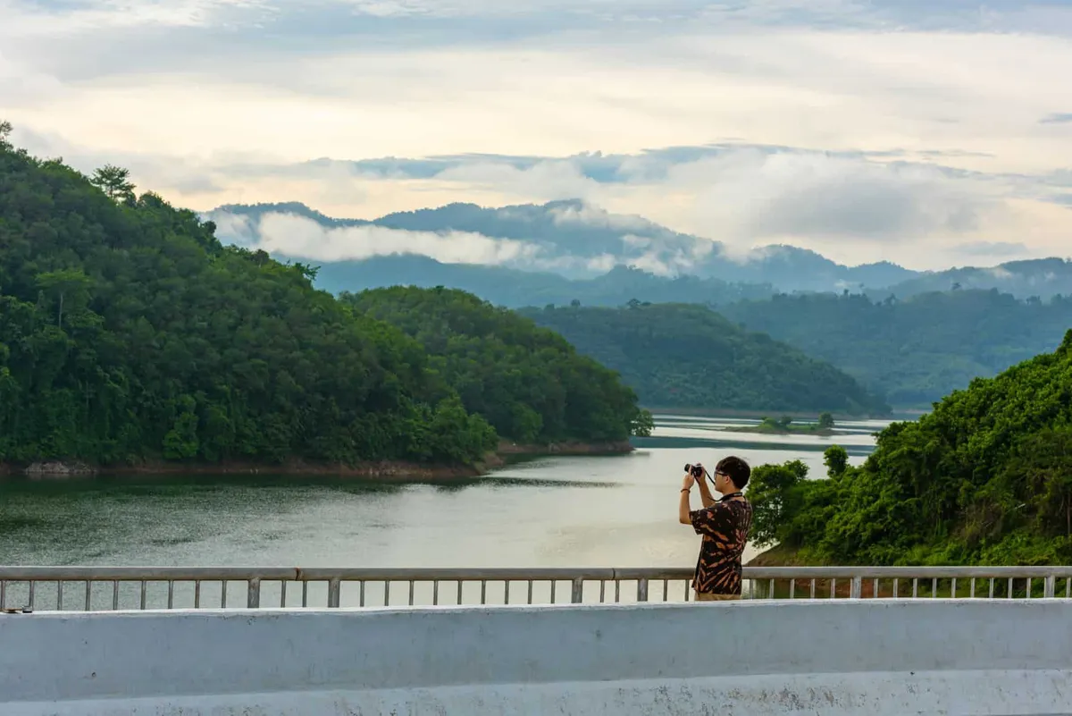
King Bhumibol Adulyadej and Queen Sirikit, with Princess Maha Chakri Sirindhorn, opened the dam on 27 September 1981. EGAT still manages the site, and the main visitor draw is the platform above the dam wall looking out over the reservoir and the forested hills of Bang Lang National Park, which borders the lake. Boat trips onto the reservoir run from the pier below, taking in stilt villages and forest that would otherwise be inaccessible by road.
Locally the dam is known as the gateway to Hala-Bala, the rainforest straddling Bannang Sata, Than To, and Betong districts that’s among the last large lowland forest blocks in peninsular Thailand. Boats heading upriver from the dam are the practical way into that forest for visitors without a specialist guide, since the terrain around the reservoir has no road access beyond the dam itself.
Early morning brings mist over the water and the coolest temperatures of the day. The reservoir sits at low elevation, but the surrounding hills hold the air still until the sun burns through. Travellers on the Yala-Betong route (Highway 410) often stop here for photos rather than making a dedicated day of it, since the dam itself has no other developed attractions beyond the view.
Watch out: Bang Lang Dam sits in Yala’s Bannang Sata district, part of Thailand’s deep South, where the Thai government and most Western foreign ministries advise checking current travel guidance before visiting: security conditions in the border provinces can shift, including occasional disruption on nearby roads. Daytime visits along the main route are standard practice for the dam itself; check with Yala tourism contacts or your embassy’s advisory before planning a trip that goes further into Betong or Than To districts.
Insider Tip: Combine the dam with Aiyoeweng Sea of Mist Viewpoint further along the same route toward Betong. Both reward an early start, and the road between them is one of the more scenic drives in the deep South.
There’s little shade directly on the viewing platform, and the site is remote enough that fuel and food are worth sorting in Yala town or Bannang Sata before heading out.
- Height / crest: 85m high, 430m crest length
- Reservoir: ~1,420 million m³
- Opened: 27 September 1981
- Hours: Daily 06:00-18:00, free entry
- Manages: EGAT (Electricity Generating Authority of Thailand)
Location & Directions
Mu 1 Si Bang Lang Road
Yala, Thailand
Show your taxi or Grab driver
เขื่อนบางลาง
Frequently Asked Questions
Is Bang Lang Dam free to visit?
Is Bang Lang Dam safe to visit given its location in Yala?
What is Bang Lang Dam used for?
Can you take a boat trip on the reservoir?
How big is the reservoir?
Spotted something out of date or incorrect? Let us know
Stay Near Bang Lang Dam
Live prices for places closest to Bang Lang Dam: tap a pin to compare.